The Best Guide to Hiking in the Grand Tetons
The Grand Teton National Park is a top destination in the U.S. for many reasons. People from all over the world come to Wyoming to go hiking in the Grand Tetons.
With over 200 miles of trails, it’s important to know what and where the best hiking in the Grand Tetons is and if it is right for you.
The list below will tell you our favorites and top picks from our time hiking in the Grand Tetons!
Why do we call them the Grand Tetons?
In the early 19th century, French trappers named the mountain range les trois tétons which translates to “the three teats” (or three boobs).
Good luck explaining that to a kid!
The Grand Teton National Park is named for Grand Teton which is the tallest mountain in the Teton Range.
Psst: Visiting the Wyoming National Parks? Check out our booze guide here: The best drinking guide to Jackson Hole Breweries, Wineries and Distilleries
**Boozing Abroad contains affiliate links throughout the site. If you choose to purchase items through these links, we will earn a small commission at NO extra cost to you. Read the full disclosure policy here**
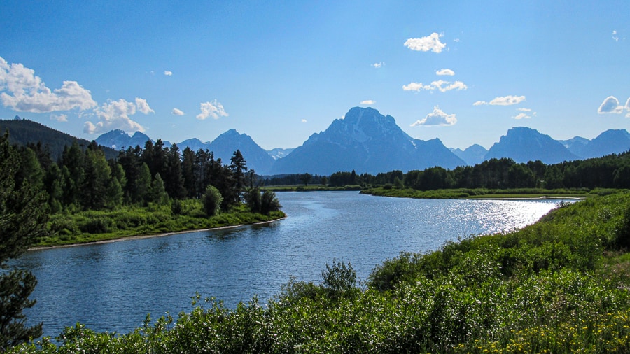
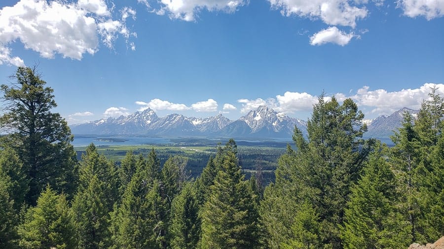
The Grand Tetons
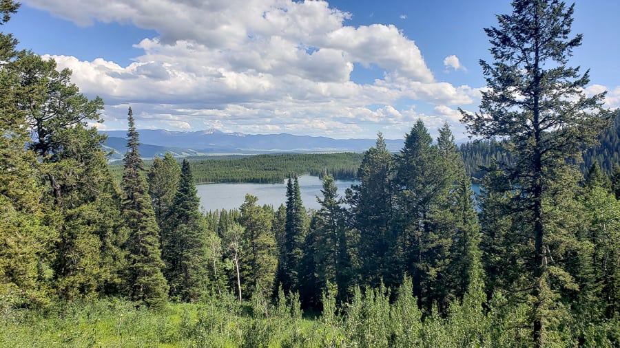
With nothing to obstruct your view in the foothills, the Teton Mountain range rises abruptly from the Jackson Hole Valley making the view sensational from most points both in and outside the park.
This landscape was formed over 10 million years ago when the tectonic plates below the surface collided, forcing blocks of rock upwards.
Earthquakes caused the rocks to rise and the valley floor dropped, forming mountain tops. Erosion slowly sculpted the landscape and massive glaciers quickly filled the valley.
Today, we are rewarded with 10 million years of beauty in the making with the jagged peaks and luscious canyons of the Grand Tetons.
Having spent over a month between Yellowstone National Park and the Grand Tetons, we are often asked “which national park has more beautiful hikes: Yellowstone or Grand Teton?”
To answer this question in brief, the Grand Tetons. The reason being is there is nothing obstructing the views from the road making this place one giant spectacle for the eyes.
HOWEVER, we did some INCREDIBLE hikes in Yellowstone and would suggest spending time hiking in Yellowstone so you can answer the question yourself.
Which spots offer incredible views of the Tetons in the Grand Teton National Park?
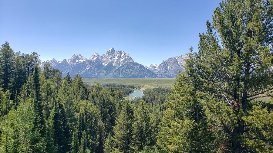
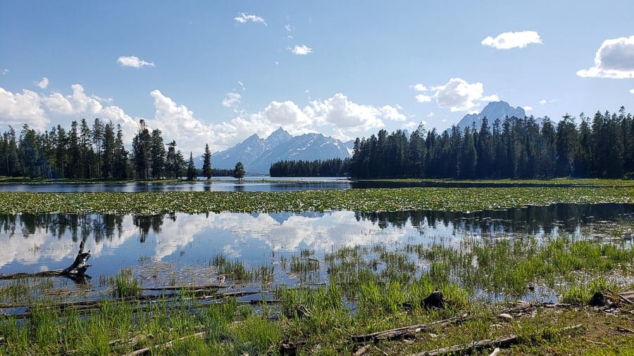
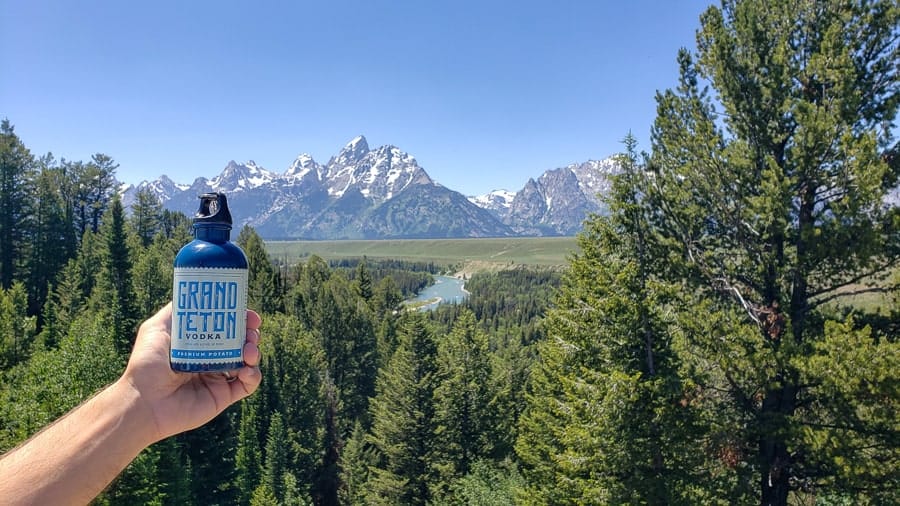
You can get incredible views of the Tetons from any scenic lookout along Teton Park Road or Interstate 191 that runs outside the park.
Our favorites were the Snake River Turnout and Glacier View Turnout. Sunrise at Moulton Barn is also a must-do! (see the section for other things to do in the Grand Tetons).
If you are looking for the best views of the Tetons on a hike, then keep reading!
Where to go hiking in the Grand Tetons?
We have two sections for hiking in the Grand Tetons.
The first section is called “easy hiking in the Grand Tetons” since they take less than 4 hours to complete.
The second section is called “day hiking in the Grand Tetons” because they required a half-day or longer to complete.
It’s important to note that all Grand Teton hiking is incredible!
Map of hikes in the Grand Tetons
Click the interactive map below!
HOW TO USE THIS MAP: To view the layers and see the names of the places on this map, click the tab in the top left corner. You can select the check marks to show or hide certain layers. If you select the icons on the map, you will get more information about the point of interest.
HOW TO SAVE THIS MAP: If you select the star icon next to the map name, you can save this map to your Google Maps account. To view it, open Google Maps in desktop or on your phone, select the menu button, go to “Your Places,” scroll to the right to Maps, and you will see this map.
Easy hiking in the Grand Tetons
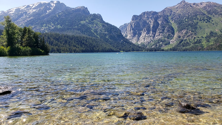
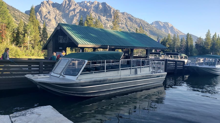
Hidden Falls
- Distance: 4.9 mile loop, about 3 hours (take the ferry and it’s about 1.3 miles, about 1 hour)
- Elevation Gain: 590 feet (via boat 230 feet)
- Location: Jenny Lake area, follow trail signs to Hidden Falls
Hidden Falls is one of the most iconic hikes in the Grand Tetons. It’s short, easy, and worth it!
The falls are stunning and the short hike is scenic with several bridge crossings and cascades.
Take the Jenny Lake ferry across the lake to save yourself the majority of the hike so you have time (and energy) to hike on to Inspiration Point and Cascade Canyon.
This hike in the Grand Tetons is the perfect hiking in the Grand Tetons option for all levels because it has minimal elevation gain and most of it is on a boardwalk.
Inspiration Point
- Distance: 6 miles round trip, about 4 hours (take the ferry and it’s about 2 miles round-trip, about 2.5 hours)
- Elevation Gain: 700 feet (via ferry boat, 420 feet in a short distance)
- Location: Jenny Lake area, follow trail to Hidden Falls, then continue the climb to Inspiration Point
Inspiration Point would be considered as moderately-strenuous hiking in the Grand Tetons.
Assuming you take the ferry boat across, you’ll hike to Hidden Falls and rapidly ascend to Inspiration Point, gaining 420 feet in under 1 mile.
You will be rewarded with great views of Jenny Lake which is why Inspiration Point is considered one of the best hikes in the Grand Tetons.
If you have the right gear and are prepared for it, you can continue past Inspiration Point to Cascade Canyon.
Taggart Lake / Bradley Lake Loop
- Distance: 5.9 miles round-trip, about 3 hours
- Elevation Gain: 800 ft
- Location: 3.5 miles north of the Moose Junction off of the Teton Park Road
The Taggart Lake-Bradley Lake Loop trail is one of the most popular day hikes in the Grand Teton National Park for its proximity to the center of the park, its relative ease, and of course for the beautiful views of the Tetons.
Located near park headquarters at Moose Junction, this 5.9-mile loop trail visits two of the glacially-formed lakes that lie at the base of the Tetons and traverses through different terrain including somewhat-heavy forest and more-open meadows.
We’d suggest doing the Bradley Lake trail first and then connecting back with the Taggart Lake trail as the incline won’t be as bad on the way out and the second half is largely downhill (either way is doable though).
When you think you’ve gotten to Bradley Lake, which is about 2 miles in, keep going to the right for about a tenth of a mile where you’ll get some fantastic views of the Tetons and other snow-capped mountains.
Once you’re done soaking it all in on Bradley Lake, head back that tenth of a mile to link up with the Taggart Lake trail and the remainder of your hike.
All of the trails are well-traveled and marked relatively well so you shouldn’t have any issues with directions.
If you’re not feeling up for the full 6-mile hike, you can shorten it to just the Taggart Lake trail which is about 3.3 miles out-and-back, and still rewards you with stunning views of the Tetons towering over the lake.
Phelps Lake Trail Loop
- Distance: 7 miles, about 4 hours
- Elevation Gain: 725 feet
- Location: Moose Junction entrance. Trailhead located in the Laurance S. Rockefeller Preserve parking lot.
The Phelps Lake Trail Loop, a 7-mile trail encircling the sixth largest lake in Grand Teton National Park, is one of the most popular hikes in the park because of its relative ease, but more so because of “Jumping Rock,” which is exactly what it sounds like.
If you dare, jump off this 25-30 foot boulder and plunge into the chilly, yet refreshing, waters of Phelps Lake (Samantha had some very different, and NSFW, words to describe the temperature of the water).
Don’t worry, it’s plenty deep.
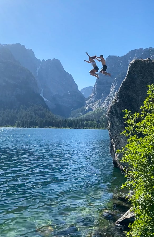
Samantha actually stepped up to the edge the first time, but after about a minute, worked herself up too much and shied away. A quick pep talk from Chris and a few minutes later and she was back up at the edge ready to jump in the deep end…literally. Fear conquered!
Located a little less than halfway into the loop on the northeastern part of the lake, this rock jump is what thrill-seekers live for.
The adrenaline rush of lifting your feet off that rock and having nothing but air between you and the cold water, with the stunning Tetons in the background, is just awesome!
It really did take our breath away because of the excitement (and probably also the cold). And if you made it this far on the hike, you can’t not jump!
Having had so much fun at the Jumping Rock, we didn’t even finish the full loop trail, but we were still treated to beautiful views of the Tetons towering over the Phelps Lake.
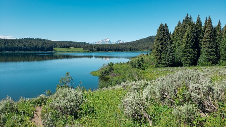
Two Ocean Lake
- Distance: 6.4 miles round trip, about 4 hours
- Elevation Gain: 400 feet
- Location: 1 mile in from the Moran Entrance, turn onto Pacific Creek Road for 2 miles, then onto a dirt road for an additional 2.5 miles
Two Ocean Lake is a lightly traveled hike passing through prime bear country. On the drive in, we spotted a mama grizzly with 2 cubs in a field.
When hiking in the Grand Tetons, bring bear spray and avoid traveling alone.
Two Ocean Lake is a moderate loop around a lake through forest and meadows and offers a ridge line view of the Teton Range.
This lake was named for the Two Ocean Plateau on the Continental Divide in Yellowstone which is a misnomer since all the water in the lake flows from the Snake River.
This hike can be combined with the Grand View Point hike below, though we don’t suggest it. We met a hiker on the path when we did the Grand View Point who said the combined hike of Two Ocean Lake and Grand View Point was mostly switchbacks and wasn’t worth the steep climb up.
It’s an additional 1.1 miles one-way to get to the viewpoint.
Grand View Point
- Distance: 1.5 miles to get to the View Point
- Elevation Gain: 800 feet
- Location: Jackson Lake Lodge area; Travel 2 miles past the Jackson Lake Junction and turn right on an unmarked dirt road and continue to the end for a parking lot
The Grand View Point trail is a steep climb that offers hikers spectacular views of the Teton Range and Jackson Lake.
While the path is mostly wooded, you will pass through a meadow with incredible wildflowers with views of the peaks of the Tetons.
We saw a few deer on this path while we were hiking in the Grand Tetons. As this path is lightly traveled, bear sightings are more likely and it’s advised to carry bear spray and avoid hiking alone.
As mentioned above, the Grand View Point trail connects to Two Ocean Lake Trail. If you chose to walk to the Two Ocean Lake trail junction, the total hike is 5.6 miles out-and-back.
The steepest part is getting to the Grand View Point so the trail becomes easier as you descend to the lakes.
Heron Pond & Swan Lake Loop
- Distance: 3 miles round trip, about 2 hours
- Elevation Gain: 200 foot, easy
- Location: Colter Bay Village via Moran Junction
The Heron Pond and Swan Lake loop is easy hiking in the Grand Tetons!
With a mostly level trail, you will weave through the forest to get to both the pond and lake. We chose to go right at the fork (the trail loops) and came to Heron Pond first.
This pond has the Teton Range in the distance and was home to, you guessed it, herons and other birds.
Past the pond, continue back into the woods until you reach Swan Lake. Named for the swans that live here, Swan Lake has a less dramatic backdrop, but just as beautiful.
When we left the lake, we saw an Elk grazing in the forest. This is a great hike for all skill levels and this is considered a classic when hiking in the Grand Tetons.
Lakeshore Trail at Colter Bay loop
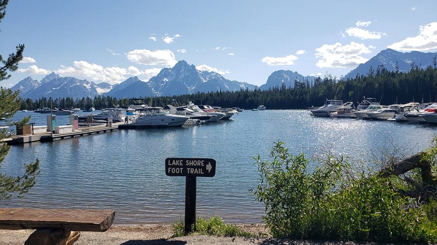
- Distance: 2 miles, about 1 hour
- Elevation Gain: 100 feet
- Location: Colter Bay Village via Moran Junction
The Lakeshore Trail is another great hiking option for all levels. This level trail follows the Colter Bay Shoreline with views of the Teton Range and Jackson Lake.
This trail is heavily trafficked and easy to follow.
This can be combined with the Heron Pond and Swan Lake loop as the trailheads are in the same parking lot.
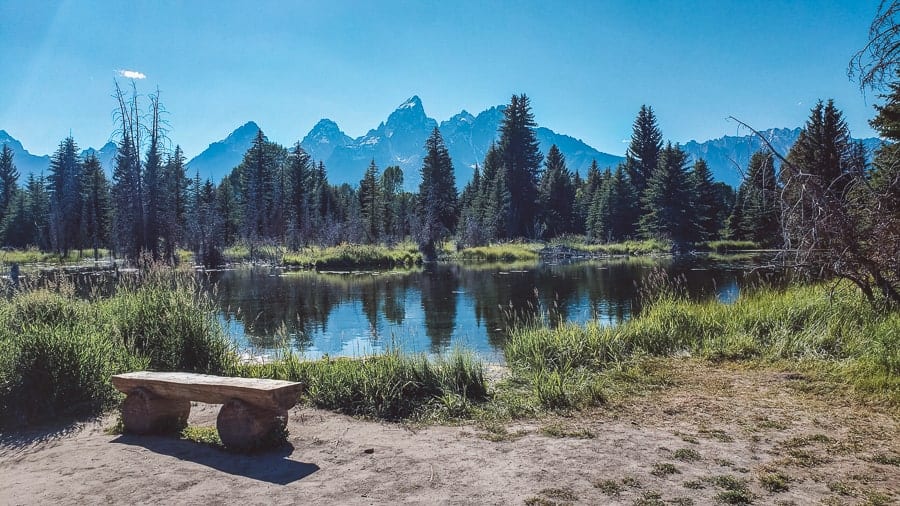
Schwabacher Landing
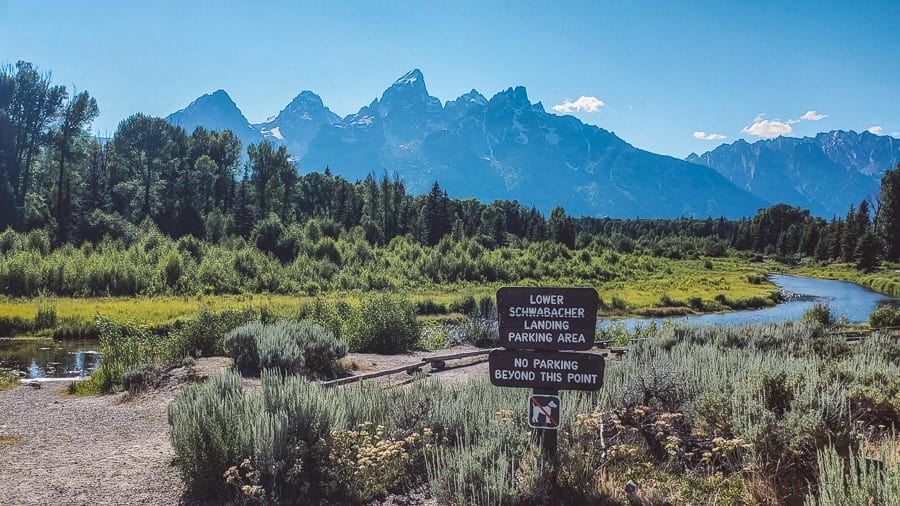
- Distance: about 2 miles round-trip, about 1-2 hours
- Elevation Gain: minimal
- Location: Off the main 191 highway, there is a parking lot that can be seen from the road. Go to the end to start this hike.
Let’s start by saying we couldn’t find any documentation of this hike anywhere so we were flying blind as to what to expect.
To our surprise, we really enjoyed this trail and will try our best to get you to the end. Note: there are creek crossings so you might get wet.
To start this hike, park at the last parking lot. Look for the “Lower Schwabacher Landing” sign and head to the right. You’ll pass a small pond and you’ll follow the path along the creek.
When you come to a fork, you can go either direction as it loops, but we chose to follow the path straight (right) along the creek until it went into the forest.
When the path merges, take a right to continue along another creek into the woods.
If you made a left at the fork, continue straight. You’ll need to cross over a rocky creek and continue on the path for another 0.5 miles until you reach Snake River.
The views from the river are great as you are much closer to the Teton Range than other hikes. It took us roughly 1.5 hours to do this trail and we were so pleasantly surprised by the outcome.
Delta Lake
- Distance: 9 miles out-and-back, about 3-5 hours
- Elevation gain: About 2,400 feet
- Location: From Lupine Meadows Trailhead, take the Amphitheater Lake Trail
If you’ve done any independent research on hiking in the Grand Tetons, you’ve probably seen reference to the Delta Lake trail, a difficult 9-mile out-and-back trek that offers stunning views of Delta Lake and the Tetons.
But this trail is non-maintained, with several boulder fields to navigate, fallen trees, and steep, loose dirt.
It’s not officially maintained by the national park, but that definitely doesn’t mean it should be skipped! Plus, because of its unofficial and non-maintained status, Delta Lake is much more secluded and picturesque than some of the other popular day-hikes.
Don’t forget your bear spray!
If you brave the steep elevation gain, you’ll be handsomely rewarded with some of the most beautiful turquoise waters and a gorgeous backdrop. It’s arguably one of the more beautiful places you’ll find within the park.
The Delta Lake Trail is not an easy hike and definitely not for the faint of heart. Much of the hike is uphill, with some boulder fields to traverse.
It’s doable though, just take it slow and follow the cairns that will guide you to this magnificent hidden treasure.
Day Hiking in the Grand Tetons
Jenny Lake Trail
- Distance: 7.1 miles round trip, about 4-5 hours
- Elevation Gain: 450 ft
- Location: South Jenny Lake is 8 miles north from the Moose Junction and the trailhead is located next to the east boat dock
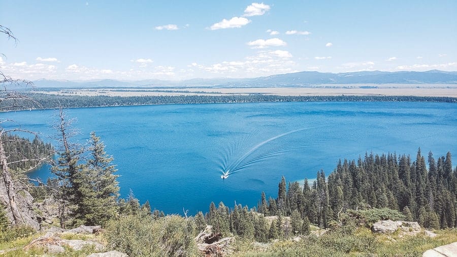
Jenny Lake is a relatively easy option for hiking in the Grand Tetons with minimal elevation gain along the lake shoreline. Jenny Lake was named after the Shoshone Indian, Jenny, who was married to a British expat named Richard “Beaver Dick” Leigh.
Together in 1872, they assisted with the Hayden expedition and both Jenny and Leigh lakes were named in their honor.
We only spent two miles hiking Jenny Lake coming back from Lake Solitude (covered under “day hiking in the Grand Tetons” section below).
It was a relatively easy and peaceful 2 miles. At the east boat dock, you’ll find a ferry that will take you across and cut about 2 miles of the trip if you are looking to go to Inspiration Point, Hidden Falls or Cascade Canyon.
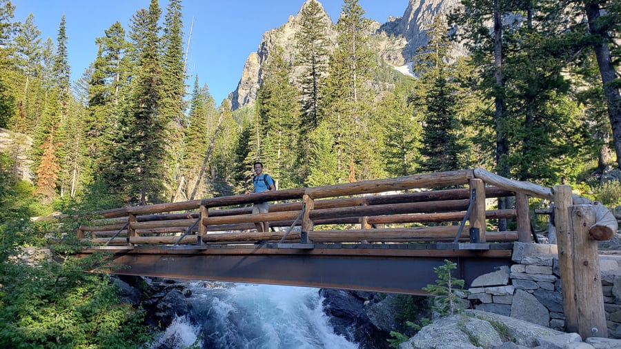
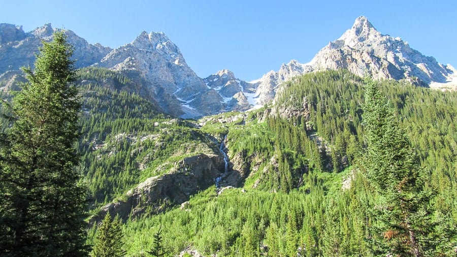
Cascade Canyon to Lake Solitude
- Distance: 19 miles round trip, about 12 hours (via ferry boat 15 miles, about 8 hours)
- Elevation Gain: 2,700 feet (via boat 2420 feet)
- Location: Follow Cascade Canyon to the Fork and make a right.
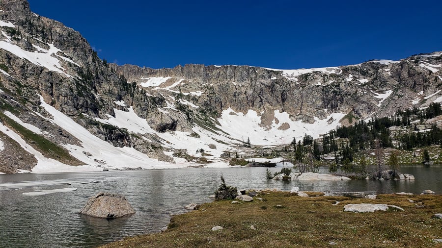
A relatively small lake located in the middle of the Teton Range, Lake Solitude sits at the end of an epic hike that lasts anywhere from 14.5 to 19 miles, depending on your route.
Our family couldn’t stop raving about this hike they did while visiting us in the Grand Tetons, so, when we finally had the chance, we knew we had to tackle this hike for our last jaunt through the Grand Tetons.
Lake Solitude is about 9.6 miles from the popular Jenny Lake Trailhead, but thankfully, the folks at Jenny Lake Boating can help you shave about 2.4 miles (each way) off of that with a short ferry ride across Jenny Lake.
From the west shore of Jenny Lake, you’ll begin a quick ascent up towards Hidden Falls and Inspiration Point, two gems on this hike, but not even the grand prize.
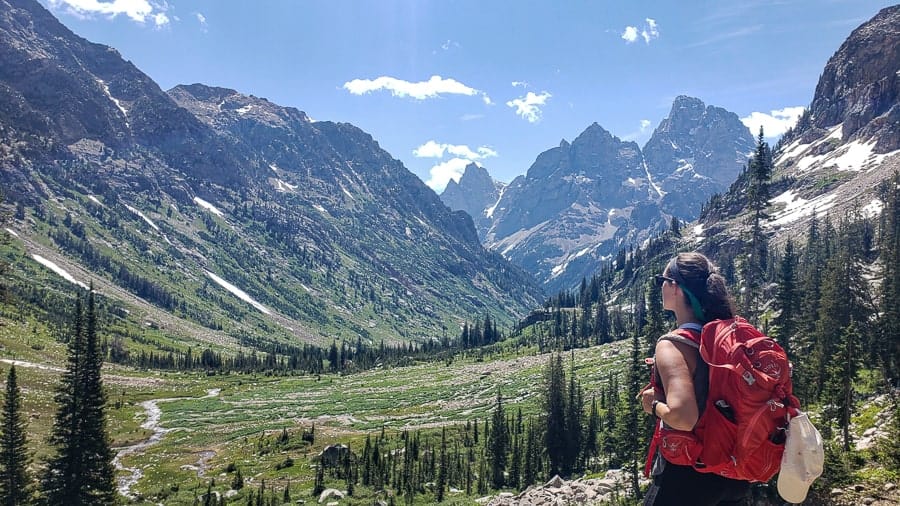
Throughout the hike, which passes right through Cascade Canyon, you are treated to countless streams, waterfalls, and endless stunning views of the giant peaks that surround the canyon.
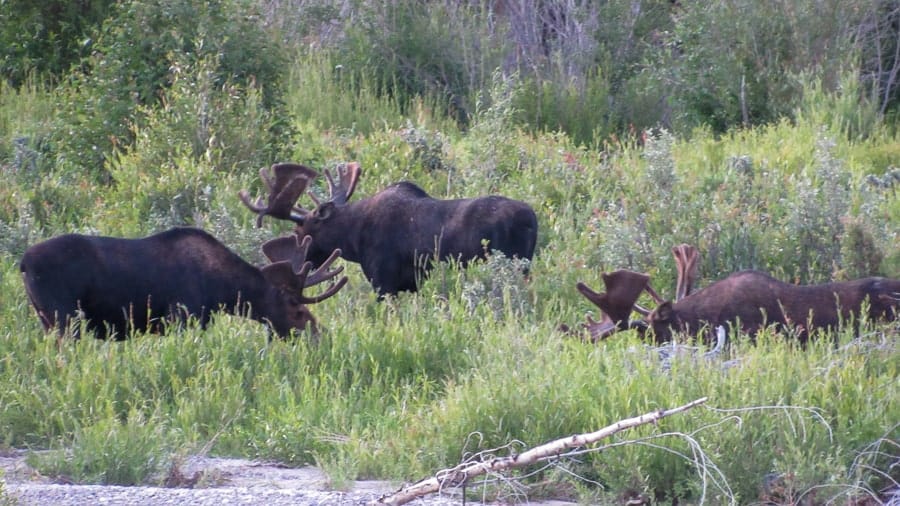
You might even see a moose, or six, like we did!
Keep an eye out for bears too as they love the huckleberry patches that are scattered across the trail.
Overall, there is an elevation gain of about 2,400 feet so you’ll probably be winded not only from the distance but also the altitude change.
While the struggle is real, we promise it’s worth hiking in the Grand Tetons.
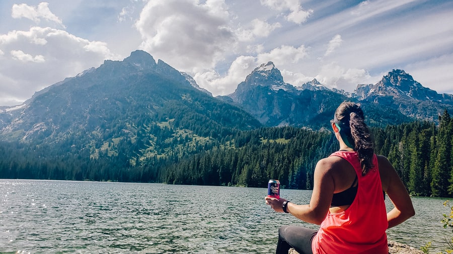
At the end of the trail, you’ll find Lake Solitude at about 9,000 feet above sea level and surrounded by snow- and glacier-capped mountains.
Words and pictures cannot begin to describe this place, but it is just a beautiful sight to see.
If you’re up for the challenge, you owe it to yourself to complete this hike in the Grand Tetons and experience the awe and beauty.
On our way back, the line for the ferry was really long, so we made the brave decision to walk the 2.4 miles back to the car instead of waiting.
All in all, 17 miles and about 41,546 steps. The longest single-day hike we’ve done to date. Definitely deserving of a beer or two!
If you are really up for a challenge, continue past Lake Solitude to Paintbrush Canyon.
Paintbrush Canyon
- Distance: 19 miles round trip, about 13 hours
- Elevation Gain: 4350 feet (this hike is considered VERY strenuous)
- Location: Trailhead either at Jenny Lake via Cascade Canyon or String Lake
Paintbrush Canyon is considered by many as very strenuous hiking in the Grand Tetons and requires an ice axe through most of July.
This hike will loop through two canyons, Cascade Canyon and Paintbrush Canyon via the Paintbrush Divide. One of our friends did this hike and said to start at dawn.
She did this hike on July 19th and needed both snow spikes and her ice axe. This hike is not for the faint of heart!
Oversized backpacks can create problems and belay ropes might also be needed. At this elevation, the wind whips at high speeds and snow and ice cover the trail.
If you do this hike, you will be rewarded with indescribable views and a great story.
Please do NOT attempt hiking this without talking to a ranger or wait until August to attempt it.
Grand Teton Hiking Tips / Gear Suggestions
Practice “Leave No Trace”
If you’re unfamiliar with “Leave No Trace”, it means to keep the land as you found it. Don’t leave trash. Stay on the marked trails. Don’t feed/pet wildlife.
Sunscreen, layers, and hats
The sun and weather can be intense on hikes and shade isn’t always available. Always carry sunscreen with you. You’ll never catch us without it.
Water, water, water
Don’t underestimate how quickly the body can dehydrate on a hike. We typically hike with our hydration bladders and suggest a minimum of 1 gallon per person, per day, depending on the length/difficulty of your hike(s).
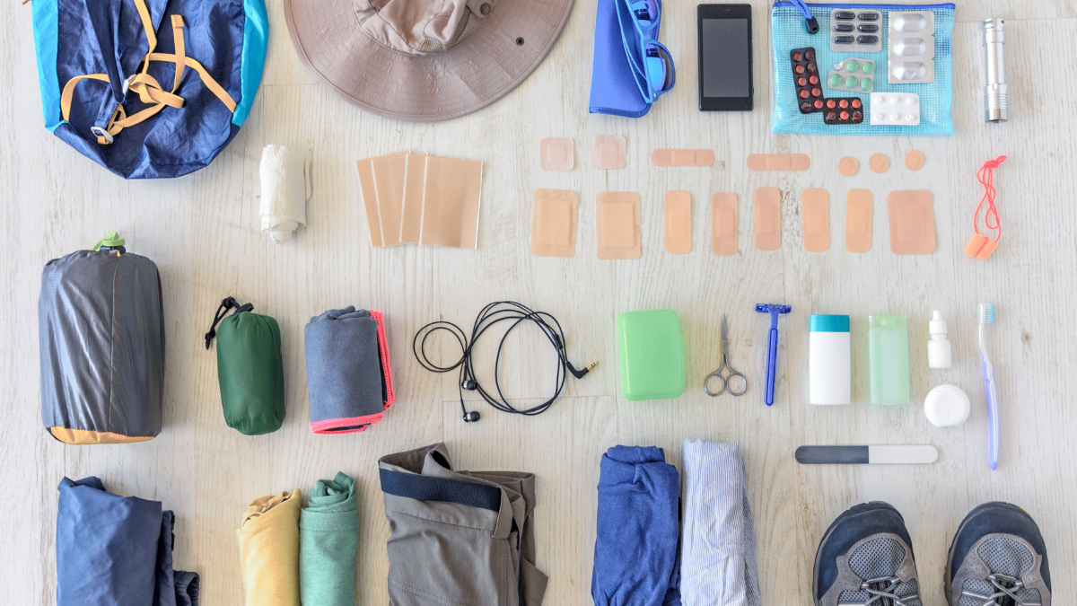
What to wear while hiking in the Grand Tetons / What to pack for a day hike?
Hiking in the Grand Tetons is both rewarding and fulfilling and should be on everyone’s bucket list.
Depending on the length of hike you are planning on doing, it’s essential to have the right gear with you before setting out on your journey.
For hikes under 4 hours, bring the following:
- Lots of water
- Sunblock / hat / sunglasses
- Bear spray
- Bug spray
- Camera
- Snacks
- Additional layers of clothing
- Good shoes – no flip flops or fashion sneakers
For lengthier (backcountry) hikes, add these items to the list above:
- Lunch
- Rain jacket/poncho
- First Aid kit
- Map
- Waterproof matches
- Ladies – consider a female urinary device. I use this all the time on long hikes and LOVE it.
- Microfiber towel
- Local Beer…duh
Wildlife on the hikes
It is impossible to NOT see wildlife when hiking in the Grand Tetons. Even if it’s just a chipmunk, the park is full of adorable creatures and some terrifying ones too.
While hiking in the Grand Tetons, we saw Elk, Moose, American Pika, Marmots, Chipmunks, Grouse, Deer, Snake and dozens of birds. While we didn’t see a bear on any hike (thank god), this is their home and you may encounter one.
For the safety of you and the animals, please maintain a safe distance.
It’s recommended by the park that you remain 25 yards (about 3 school bus lengths) away from all animals.
For bears, 100 yards (a football field length) is the correct distance. Bears, especially with cubs, are VERY aggressive and you can be in great danger if you don’t heed the warnings.
Other Things to do in the Grand Tetons
Moulton Barn
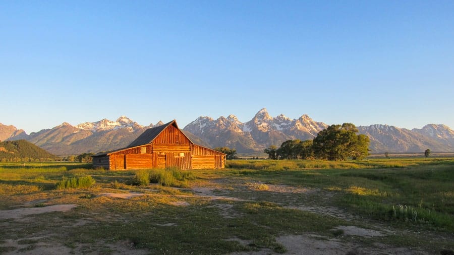
Widely considered the most photographed barn in America (apparently, that’s a thing), the T.A. Moulton Barn dates back to when Mormon settlers came from Idaho and established communities on this land.
Built in the early 1900s by one of those Mormon settlers Thomas Alma Moulton (it took 30 years to build), and now within Grand Teton National Park, this barn is one of the few structures still standing from the historic Mormon Row and is an iconic symbol of Jackson Hole and the Tetons.
A quick Google search of “Grand Tetons” and you’ll no doubt find a very similar picture to ours with the majestic Tetons looming in the background.
We braved the chilly temperatures and very early morning to experience sunrise at this popular spot. Seeing the sun slowly rise up and shine light on the tips of the mountains and then finally on the barn was so awesome!
It was so peaceful and beautiful that you can see why this is such a popular attraction for visitors.
Side note: T.A. Moulton’s brother, John, also built a barn in this area which is just north of the more-famous barn.
Eager photographers often capture the wrong barn in their photos. Regardless, it’s still beautiful, but look for the more pointed roof if you want the social media-worthy T.A. Moulton Barn.
Drink Local
Jackson, WY is the gateway to the Grand Teton National Park. Despite the population of only 10,000, there are plenty of local booze places to check out while you are visiting.
>>>To read more about the local winery and breweries, check out our Jackson Hole Booze post.<<<<
Overall Hiking in the Grand Tetons
Some of the most beautiful hiking in the Grand Tetons is accessible in under a day. With dozens of trails for all skill levels, you will be sure to find a Grand Teton hike that is right for you.
If you are planning your trip, we suggest at least 4-5 full days to be able to enjoy all the hiking this park offers.