The Complete guide for Mount Fitz Roy hike from El Chalten, Argentina
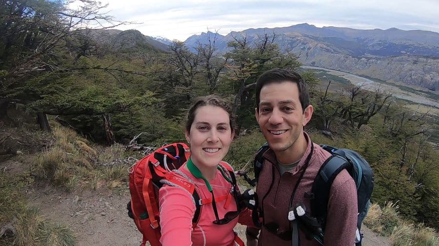
The Monte Fitz Roy hike is arguably one of the most breathtaking trails in Patagonia, Argentina. Yes, we know that’s a bold statement.
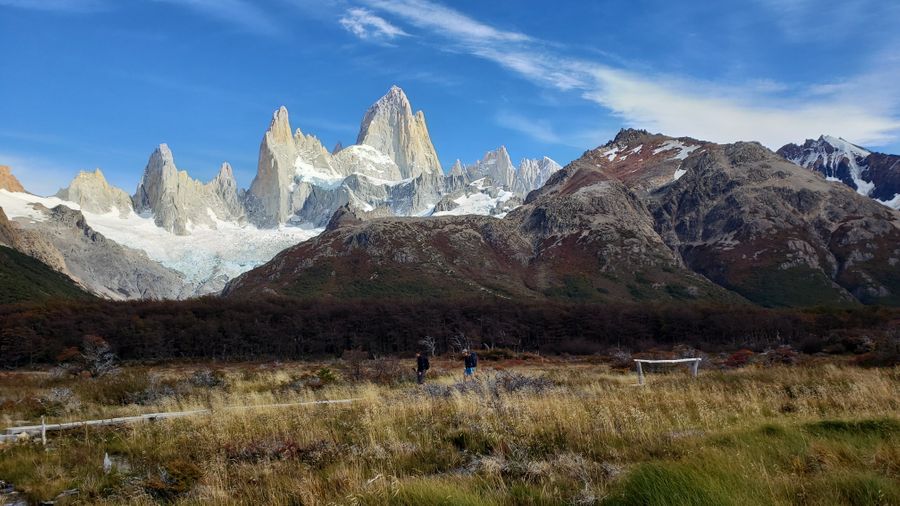
Monte Fitz Roy (also known as Cerro Fitz Roy or Cerro Chaltén) marks part of the border between Argentina and Chile, and the famous Laguna de los Tres is the crown jewel hike leading to its base.
If the silhouette looks familiar, that’s because the Patagonia clothing brand logo was inspired by Monte Fitz Roy’s jagged peaks.
We’ll be honest – we didn’t train for this hike. The fact that we were brewery hopping in Buenos Aires just days before should put that in perspective.
While the Fitz Roy trek is often labeled “moderately challenging,” we’d say it leans toward the difficult side, especially if you’re not in peak hiking shape (like us).
This step-by-step hiking guide will walk you through everything you need to know for trekking Monte Fitz Roy and the Laguna de los Tres trail – from what to expect to when to use hiking poles.
Short on Time? Here are the key takeaways:
- The Monte Fitz Roy trail is considered “moderately challenging,” but the first and last 2 kilometers are the toughest due to steep elevation gain.
- Trekking poles aren’t essential until the final climb (around KM 9), but we were glad to have them.
- The Laguna de los Tres hike can easily be done in a day if you’d rather skip camping.
- The total trail distance is roughly 20 km (12.5 miles) round-trip and takes most hikers 8-10 hours to complete.
- You can rent all hiking gear in El Chaltén, the small mountain town that serves as the base for the Monte Fitz Roy trek.
This post was originally published in April 2019, and was updated in November 2025.
**Boozing Abroad contains affiliate links throughout the site. If you choose to purchase items through these links, we will earn a small commission at NO extra cost to you. Read the full disclosure policy here**
Quick Overview of Patagonia and Monte Fitz Roy
The name Patagonia came from Ferdinand Magellan who thought the Tehuelche Indians looked liked ‘Patagon’, a dog-headed monster from a 16th-century Spanish romance novel. From then on, the original inhabitants were known as Patagones.
Seriously?! We can’t make this up. When we found this from the encyclopedia, we had to share it.
Today, Patagonia spans southern Argentina and Chile, covering more than 260,000 square miles (673,000 square kilometers) of mountains, grasslands, and glaciers – including the legendary Monte Fitz Roy, which rises 11,171 feet (3,405 meters) above Los Glaciares National Park.
Located just outside El Chaltén, Monte Fitz Roy is the most famous peak in the park and is accessible via the Laguna de los Tres trail, one of the most popular hikes in Argentina.
>> READ MORE: Complete Guide to El Chaltén Argentina, Basecamp to Patagonia
Renting Hiking Equipment in El Chaltén
We rented trekking poles from a shop appropriately named Patagonia Hikes, but there are at least half a dozen rental stores in town.
The last kilometer of the Laguna de los Tres trail is steep and rocky, so poles can be a lifesaver. We rented adjustable telescopic poles for 10,000 ARS (about $7 USD) per pair per day – totally worth it.
If you break them (a replacement costs around $160 USD) which could be less expensive (depending on the poles you buy) than buying new poles and hauling them across Argentina. Unless you’re particularly attached to your own gear, renting in El Chaltén is the way to go.
>> Here is a link to their site where you can download a list of all the equipment you can rent. To be honest, if we were camping, we’d probably rent everything we needed.
Price it out for yourself, but it might be cheaper (and easier) than lugging it all with you around Argentina – unless you are badass and here solely for hiking.
What to Pack for the Monte Fitz Roy Hike
Before you hit the trail, make sure you’re properly packed for Patagonia’s unpredictable weather. From waterproof layers to trekking poles and quick-dry clothing, being prepared makes all the difference out here.
We’ve put together a detailed Patagonia Packing List for Patagonia that covers everything you’ll need for hiking Monte Fitz Roy – including gear we personally used on this trek.

Monte Fitz Roy Hiking Tours and Guided Options
If hiking Monte Fitz Roy solo feels intimidating, several guided treks and camping tours are available.
Check out these popular El Chaltén tours on Viator:
- Full Day Trekking to Mount Fitz Roy: Professionally guided with stunning viewpoints of Laguna de los Tres. Bring your own food and gear.
- 2-Day Hiking Guide (Fitz Roy and Cerro Torre): Includes camping equipment, meals, and an expert guide – perfect for adventure travelers.
See all El Chaltén and Patagonia tours on Viator for additional options.
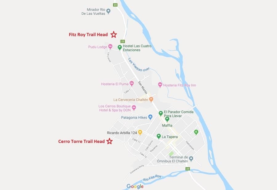
How to Find the Laguna de los Tres Trailhead
With the small size of El Chaltén, this should have been more straightforward; but a lack of sleep and no caffeine made this fun at 6:30AM.
We want to spell this out for you since it took us an embarrassingly long time to find it (again, we weren’t hikers at the time and there are literally a dozen different trailheads in town).
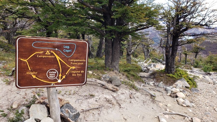
It’s near the top of the map below (downtown El Chaltén is basically the bottom half of the map):
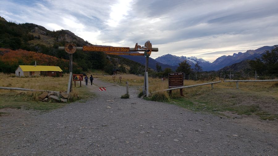
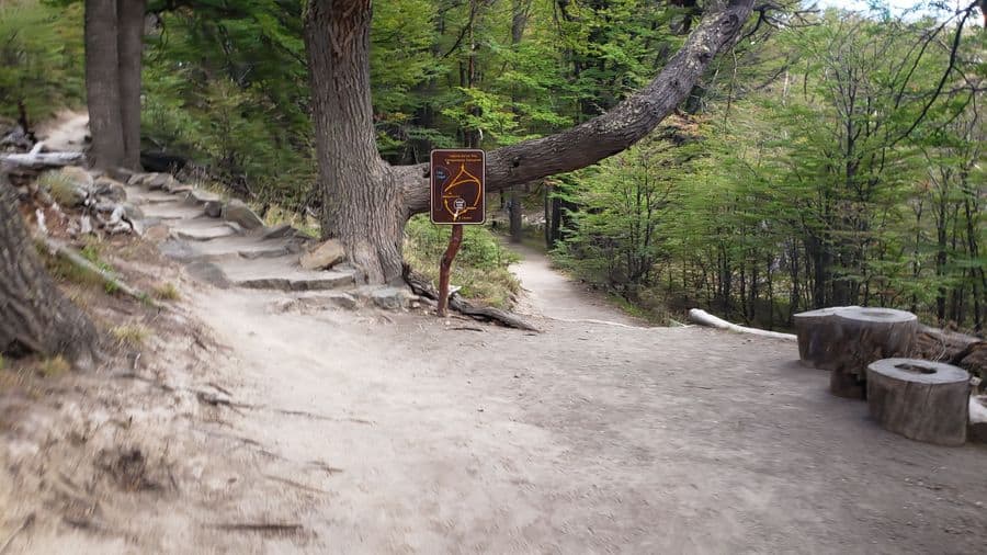
Once you know where it is, it’s hard to miss the big sign that reads “Sendero al Fitz Roy”.
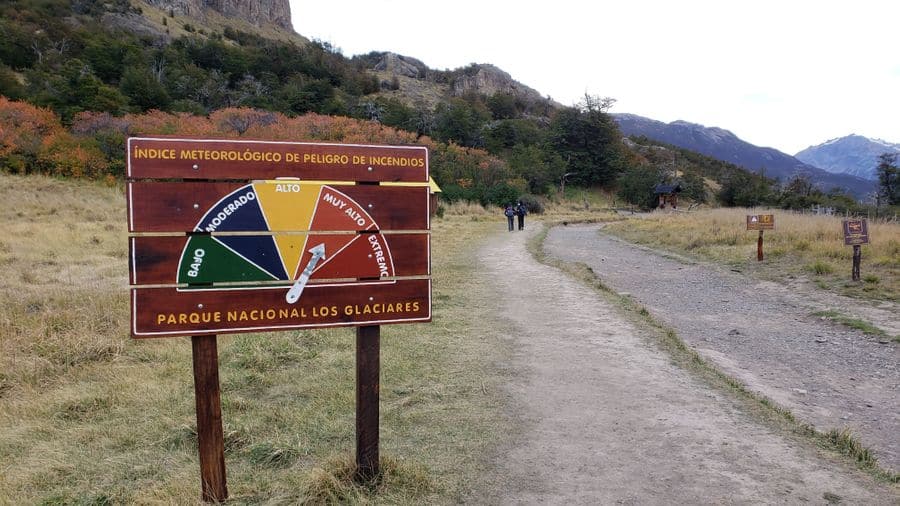
If you don’t know Spanish, you will also see this sign below and might assume it’s talking about the trail difficulty – it’s not. It’s talking about the fire danger.
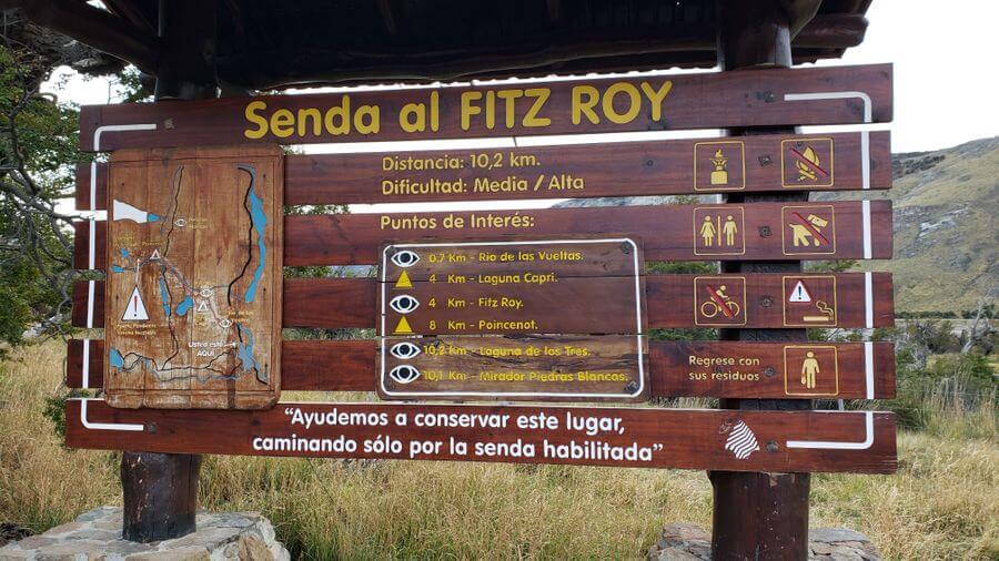
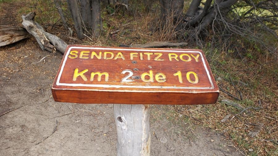
The sign below is where they begin to track the kilometer readings on the path. The Laguna de los Tres hike is clearly marked and you can do it easily without a guide.
Each kilometer is marked so you know your progress as you hike.
From here, you start your epic journey.
Monte Fitz Roy Hike -Laguna de los Tres
LIf you only do one big hike in El Chaltén, make it Laguna de los Tres. It’s the most famous route to the base of Monte Fitz Roy and one of the most rewarding treks in all of Patagonia.
Quick Facts:
- Distance: 20 km (12.4 miles) round trip
- Time: 8–10 hours total
- Difficulty: Moderate to hard due to steep elevation in the first and last 2 km
- Best Start Time: Early morning to catch the sunrise glow on Fitz Roy
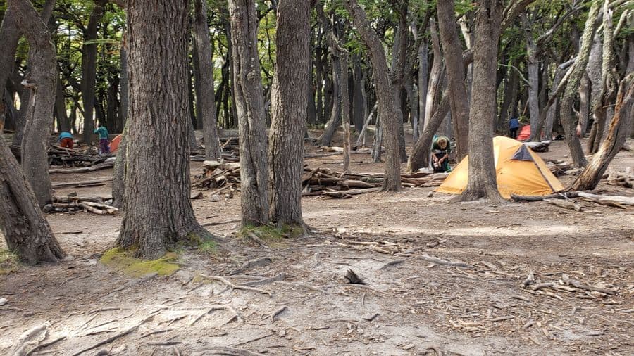
- Campsites: Campamento Poincenot (KM 8) and Campamento Laguna Capri (KM 3.5)
- Water: Drinkable straight from streams and lakes, no filter needed
If you’re camping, fires are not allowed, so plan for cold meals or a camping stove. The Madre e Hija trail connects to the Cerro Torre route if you’re planning a longer, multi-day adventure.
We did the Cerro Torre hike the next day and it felt like a breeze in comparison, but both hikes are absolutely worth it.
Kilometers 0 – 2: Trailhead to the First Viewpoint
Climb a small mountain – uphill 75-80% of the time
KM 1: The start of this hike will leave you gasping for as the first kilometer is pretty much straight uphill. It’s a great first test to make sure you are committed!
As it’s shaded by trees with no view, put your camera away until you get the to Mirador (viewpoint) Rio de las Vueltas about 0.7 km from the sign at the beginning.
We rested for a few minutes here since our calf muscles were burning and we just started this damn hike (remember, we said we weren’t in shape for this hike).
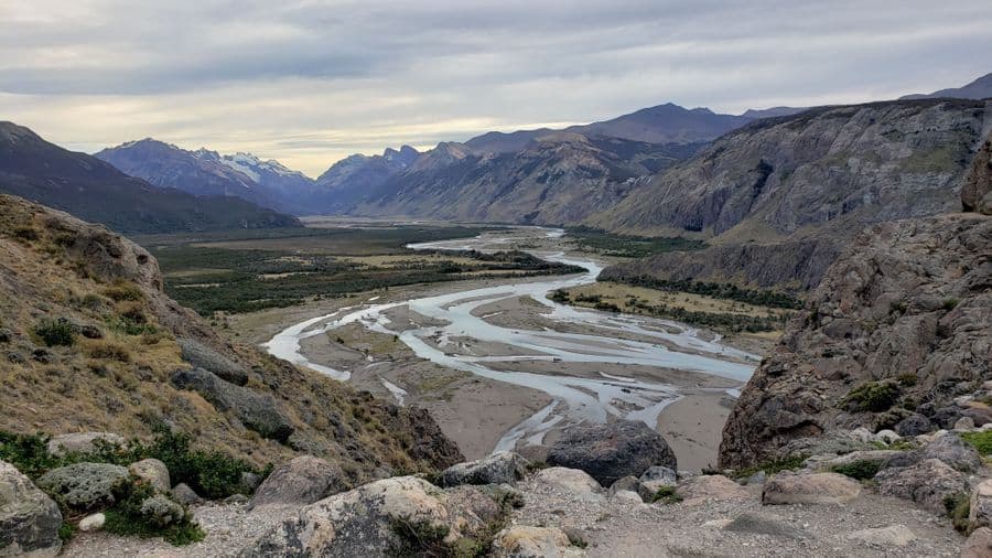
Here, we pulled out the cameras as the next kilometer is a great view of the valley and river below.
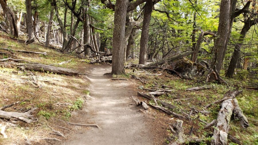
KM 2: Go in and out of the forest and will start to level out.
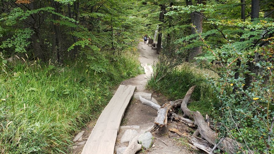
Kilometers 3 – 5: The Forest Stretch
Over the hill and through the woods (Grandma’s house doesn’t await you)
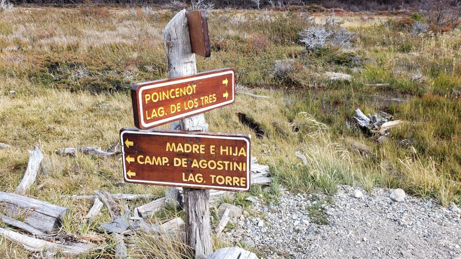
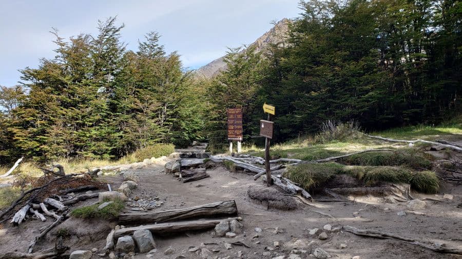
KM 3: Not even 1 minute after the sign for kilometer 3, the path splits.
As you can see below, the path is a circle, so whatever way you pick on the outbound, choose the other one on the return.
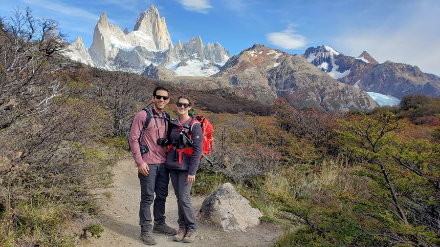
No matter which direction you go, you will be rewarded with a view Mount Fitz Roy.
If you go right, you will end up at the Mirador (pictured below).
It was here at this viewpoint that we got our first true glimpse of why people make this trek!
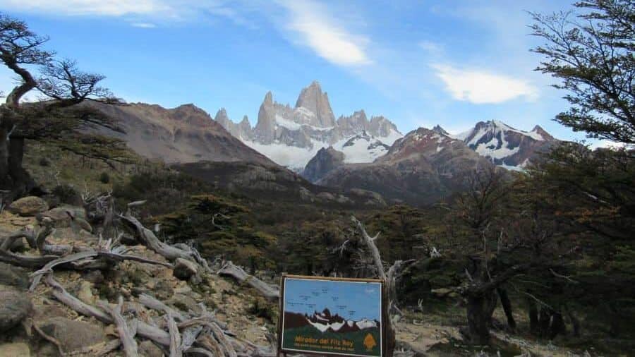
The sign details the stunning scenery and explains the landscape in front of you. If you can make it here at sunrise, I can’t imagine just how beautiful it would be.
Also, this is also where we first experienced the full force of the legendary Patagonian winds they talk about. We quickly through another layer on.
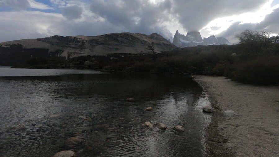
If you go left at the fork (pictured above), you will find the first campsite, a toilet and a view of Fitz Roy mountain over Lago Capri. This picture below from the lake was from our walk back.
Making your way around the loop, you will walk in and out of trees and brush while continuing to see Fitz Roy mountain.
KM 4: Past the 4-kilometer mark, you will come to another fork in the road.
Follow the arrows to Laguna de los Tres and Compamento Poicenot.
KM 5: This will be in the woods (short, uncovered trees) and relatively flat with rewarding views and will open up towards the end to a flat, open valley.
Kilometers 6 – 7: Flat trail with Epic Views
The Calm Before the Storm
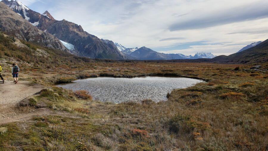
KM 6: This will be a welcome change of scenery with an open, flat trail that leads around a small pond with Monte Fitz Roy’s peak teasing you as you continue to walk along the path.
If you are running low on water, there will be a stream on the right that you can walk to for a refill.
Water will be easily accessible from this point through kilometer 10.
KM 7: This will be mostly open with more river and marsh crossings, and still with gorgeous views.
Here, you will also see this fork in the road below. If you were looking to go to Laguna Torre (aka Cerro Torre hike) in the same day (because you’re either crazy or a badass), this is where you can pick up the path here on the way back.
Kilometers 8 – 9: Approaching Campamento Poincenot
Camping at Campamento Poincenot
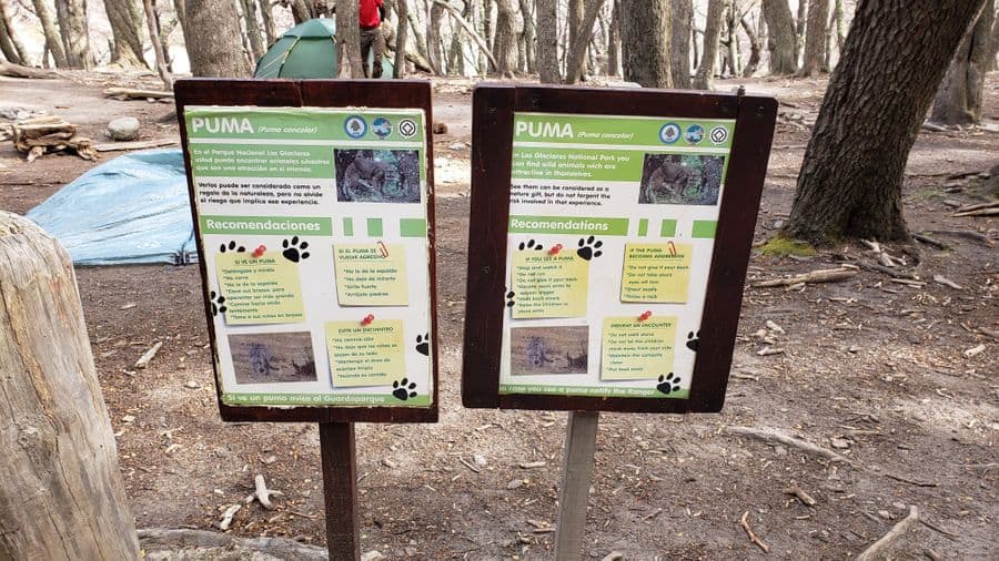
KM 8: This is the second of the campsites on the trail and is flat and under large trees.
There will be signs to let you know you’ve arrived as well as a Puma warning (yes, the big kitty). There is a toilet here as well.
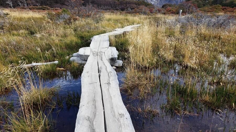
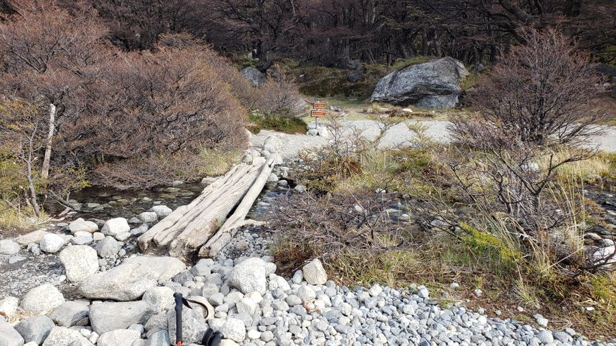
There are several small streams with bridges you will cross as you start to get into more rocky terrain.

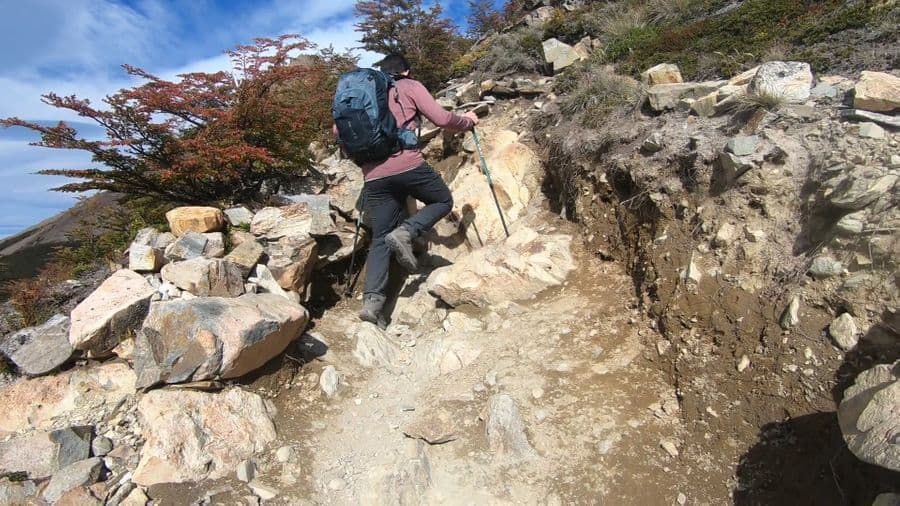
Kilometers 9 – 10: The Final Climb
Challenging: (Adjective) meaning difficult to do and involving a lot of effort
You know in a fairy tale when the hero is just about to accomplish something epic, but a dragon shows up, spits fire, releases havoc, and then there is a big fight scene before you can move forward?
This is that point of the story.
The warning sign at the base of this reads, “Good physical condition is required.”
They aren’t joking.
Get your trekking poles out.
Make sure your laces are tight because you are about to fight a dragon.
This isn’t shaded either, so put on your hat and sunglasses and reapply sunscreen now.
The very last part of this hike gains elevation at 400 meters per kilometer – in layman’s terms – this is steep.
It takes roughly 1 hour to get up if you don’t stop.
It took us around 1 hour and 15 minutes.
Roughly a 45-degree angle up, you are ascending a mountain. You will feel the burn with every step and to make matters worse, the majority of this is very rocky with loose gravel.
Feeling hopeless on this part of the hike, you make it to what you think is the top. Because the universe wants to test your sanity, the path flattens out, and you think you’ve made it.
Then you look forward and what lies ahead can only be described as a hill that continues to ascend on an open, steep, and pebbly path.
You climb the slippery, windy path to the top, with the sun beating down on you, and then finally…..
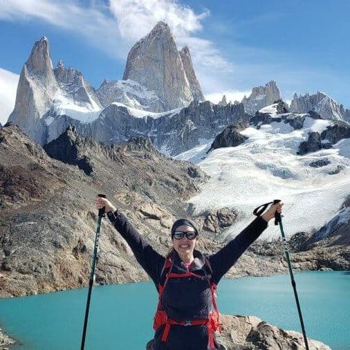
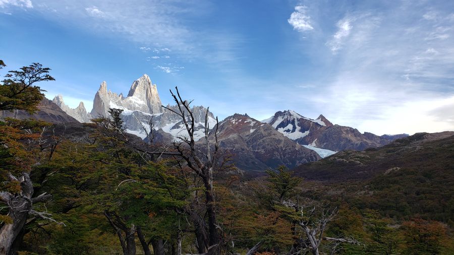
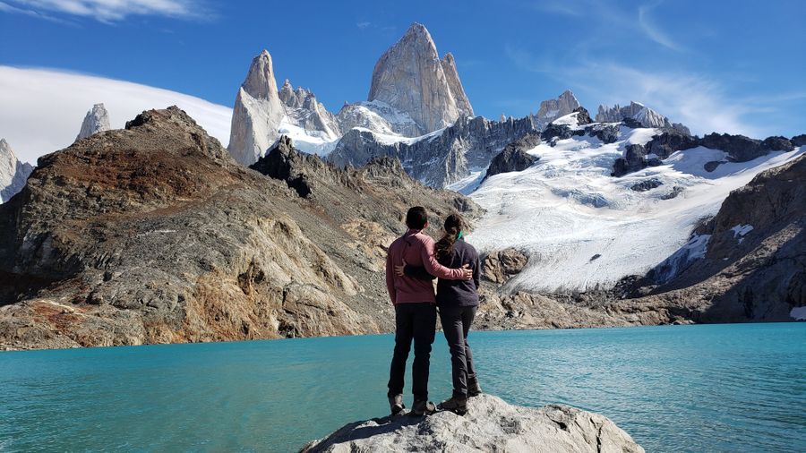
You Made it: The Summit View of Monte Fitz Roy
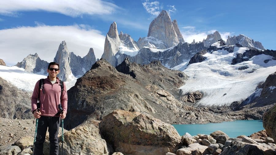
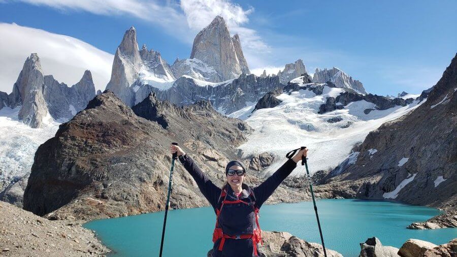
The only sound you can hear against the wind is your heart pounding in your ears. Your legs feel as though they might give out and your lungs literally might explode out of your chest.
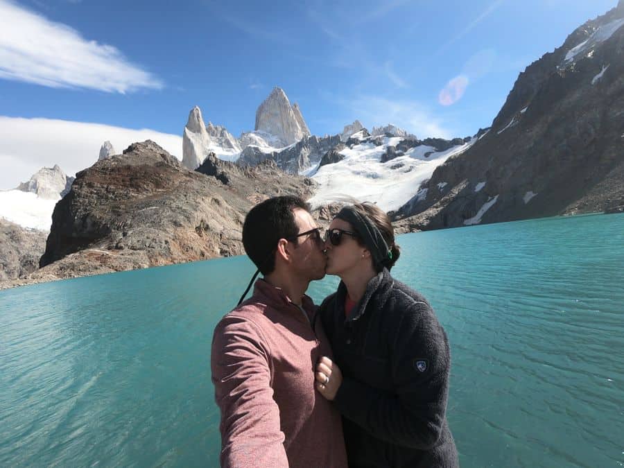
Take a rest on the rocks near the top, eat your lunch, and enjoy the view of the incredible Monte Fitz Roy. And bask in the glory of accomplishing a pretty challenging ascent.
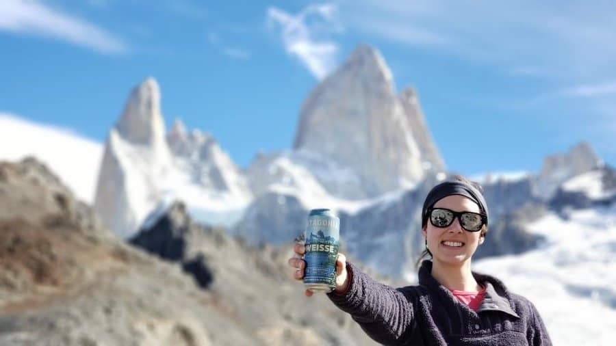
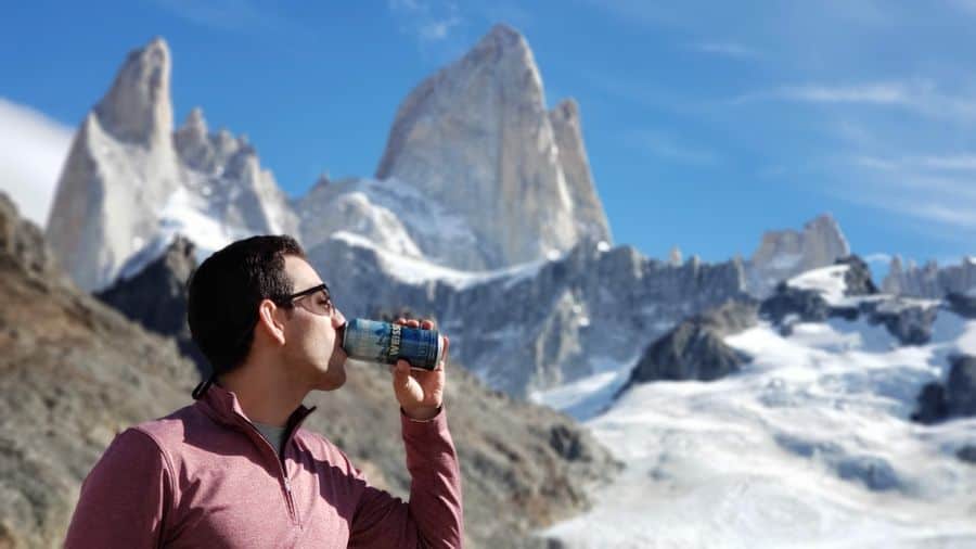
We ventured down the hill to the Laguna de los Tres lake where we refilled a water bottle, took several photos, and shared a beer. Yes, a beer. A Patagonia beer, of course!
From here, there is another 2 kilometer hike that takes you to different vantage points, but we were too tired (and honestly, out of shape) to even fathom that hike.
We also reached the summit at 1:20PM, having started later than planned. We started at 9:03AM so it took us roughly 4.5 hours to reach the end.
We sat for about 20 minutes relaxing, stretching, and eating lunch and then another 20 minutes by the lake.
If you only have time for 1 hike near El Chaltén, you need to do this one. Was the last part brutal? Absolutely — but 1000% worth it!
To see a virtual tour of the hike, which is the coolest thing I’ve seen, click here. Click on “Virtual Tour” and press “Start Virtual Tour”.
You can see what the entire path looks like from a bird’s eye view!
Tips for Hiking Monte Fitz Roy (Things We Wish We Knew Beforehand)
The first lookout point is only an hour into the hike. If you can time it for sunrise, do it.
Shame on us for not doing enough research as I’m sure this is somewhere on the web, but we didn’t know and would have altered our time accordingly.
The “toilets” on the trail are 4 walls with a massive hole in the floor. Thinking about the smell still makes us gag. (Side note: Who’s job is this to maintain the hole and how is it cleaned?
Are you telling me you carry crap (literally) for kilometers out of the park?!)
Ladies, as previously mentioned in the What to Pack post, Samantha purchased a Female Urinary Director and she’s beyond grateful she did. This saved her from having to squat over this hole.
It’s awkward, yes, but she couldn’t have imagined peeing without it on this hike.
Monte Fitz Roy is without a doubt the longest (and most challenging) hike we’ve ever done.
Well, we’ve only ever done a handful together at this point in our lives with this being one of them.
The hike to the top was spectacular as the peak of Fitz Roy mountain was seen the majority of the hike.
We were told by fellow hikers who had done Torres del Paine that you aren’t able to see the peaks until the very end of that hike so we were constantly amazed at the beauty of the landscape the entire time.
Hiking in Patagonia isn’t necessarily a bucket list item for everyone. The physical requirements alone rule out a large portion of the world’s population as you must push your body to the max.
If we are being honest, we can’t believe we did it. There were several times Samantha muttered, “leave me here” as she was gasping to breathe.
Granted, we aren’t in the best shape of our lives either.
You can’t have a booze blog, drink beer all the time, and expect this to be easy!
Hotels Near the Monte Fitz Roy Trailhead
You can walk across town in about 15 minutes, so no matter where you stay, you’ll be close to everything. Most restaurants, bars, and shops are along the two main streets, making it easy to get around without a car.
Here are a couple great places to stay near the Monte Fitz Roy trailhead:
Rancho Grande – Hostel
A classic backpacker spot less than a minute from the trailhead. Perfect if you want to crash right after the hike. Dorm-style rooms, budget-friendly prices, and a solid on-site restaurant with massive portions.
>> Check current prices and availability at Rancho Grande.
Hosteria El Puma – Hotel
Located right on the main street, this hotel offers larger rooms, on-site laundry, and a short walk to the Fitz Roy trailhead. Great for those who want a mix of comfort and convenience.
>> Check current prices and availability at Hosteria El Puma.
None of those fit what you are looking for? Click here to see all hotels available and their current prices.
Monte Fitz Roy pushed us harder than any other hike we’ve done, but it’s also one of the most breathtaking experiences of our travels. From the mirror-perfect reflection at Laguna de los Tres to the relentless Patagonian wind, this trek is pure magic.
If you’re planning your trip, pack smart, check the weather before you go, and give yourself extra time to explore El Chaltén’s other trails, cafes, and breweries. You’ll quickly see why this tiny mountain town is called the hiking capital of Argentina.
If you’re visiting El Chaltén, check out our other Argentina guides:
- Complete Hiking Guide for Cerro Torre
- Patagonia Packing List: What to Pack for El Chaltén, Argentina
- El Chaltén Travel Guide – Best Things to Do in Patagonia
- Breweries in El Chalten, Argentina: Best Places to Drink Local Beer
Ready to visit to El Chalten? Read hotel reviews, check current prices and then book your room here!
Don’t forget to pick up an Argentina guidebook for your other adventures.
Love this guide? Have questions? Get in touch with us on Facebook | Instagram | Pinterest