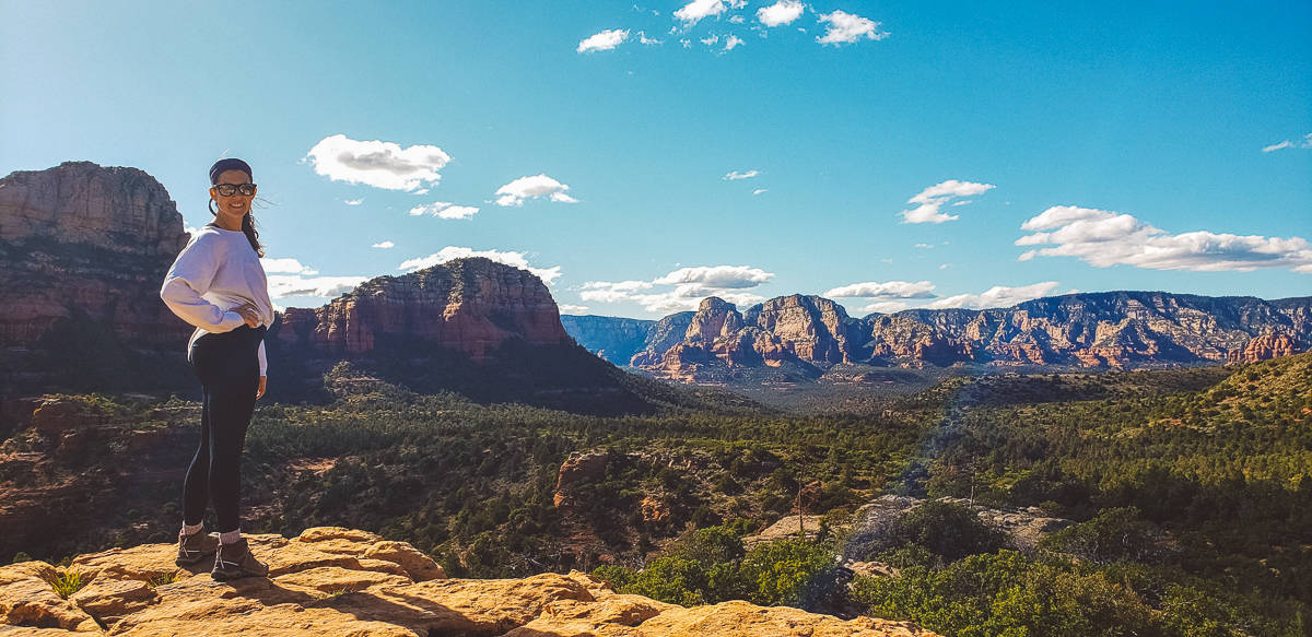
Top 5 most popular short hikes in Sedona, AZ
Looking for the best short hikes in Sedona that deliver big red rock views without taking all day? You’re in the right place.
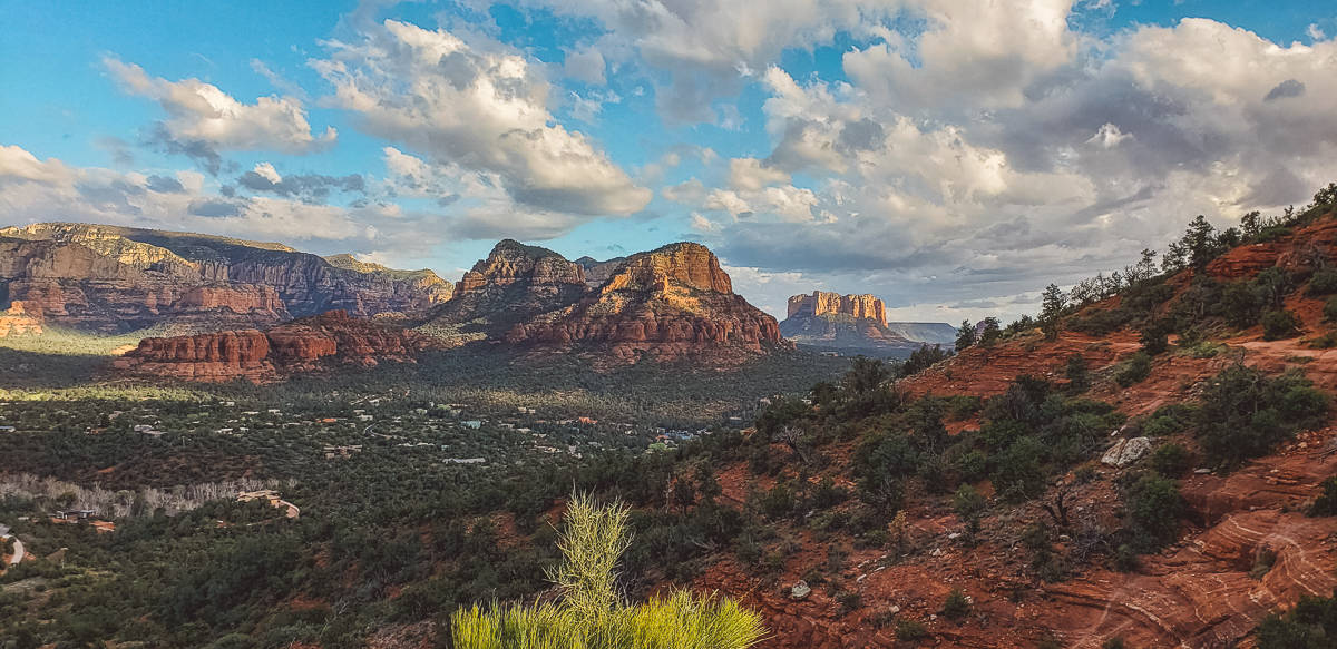
Sedona has dozens of incredible hiking trails, but these five short hikes – all under five miles – are the ones we think every visitor should experience. Each one offers its own mix of scenery, adventure, and classic Sedona magic, making them perfect for half-day hikes or quick morning adventures before lunch in town.
From jaw-dropping overlooks to hidden caves, these trails are short on mileage but big on reward.
Short on Time? Here are the key takeaways:
- Devil’s Bridge – Sedona’s most iconic arch and photo spot.
- Cathedral Rock – Short, steep, and the best panoramic views.
- Soldier Pass – Caves, arches, sinkholes, and the Seven Sacred Pools.
- Birthing Cave – Quick hike to a hidden cave with epic views.
- Airport Loop – Easy loop with vortex energy and 360° scenery.
Updated in October 31, 2025 to include the latest trail details and tips.
**Boozing Abroad contains affiliate links throughout the site. If you choose to purchase items through these links, we will earn a small commission at NO extra cost to you. Read the full disclosure policy here**
Do You Need a Red Rocks Pass in Sedona?
Most Sedona hiking trails, including several of the short hikes on this list, are located on Coconino National Forest land – which means you’ll need a Red Rocks Pass to park.
You can purchase one at trailhead kiosks, visitor centers, or online. Pass options include:
- Day Pass: $5
- Weekly Pass: $15
- Annual Pass: $20
- America the Beautiful National Park Pass: $80 (also valid here)
Make sure to display your pass clearly on your dashboard to avoid a ticket. You can buy the passes here.
If you’re only stopping briefly – like taking a photo or soaking in the view for 15 minutes or less – you don’t need one. But for any actual hiking, even the short ones, it’s required.
Pro Tip: Buy your pass ahead of time online or at a local gas station – it’ll save you time at crowded trailheads.
Map – trailheads for short hikes in Sedona
Click the interactive map below!
HOW TO USE THIS MAP: To view the layers and see the names of the places on this map, click the tab in the top left corner. You can select the check marks to show or hide certain layers. If you select the icons on the map, you will get more information about the point of interest.
HOW TO SAVE THIS MAP: If you select the star icon next to the map name, you can save this map to your Google Maps account. To view it, open Google Maps in desktop or on your phone, select the menu button, go to “Your Places,” scroll to the right to Maps, and you will see this map.
1. Soldier Pass
- Distance: 4.1 miles, out-and-back
- Elevation Gain: 620 feet (more if you climb to the cave)
- Why it’s awesome: Multiple natural landmarks, including Devil’s Kitchen, the Seven Sacred Pools, Soldier Pass Arch, and a secret cave.
If you only have time for one of the short hikes in Sedona, make it Soldier Pass Trail. It’s the perfect showcase of everything Sedona does best – red rocks, arches, caves, sinkholes, and sweeping views – all packed into a manageable route.
Parking Tips (Read This First)
The hardest part about this hike isn’t the trail – it’s the parking. The Soldier Pass lot has room for only about 15 cars and is open 8 AM to 6 PM. The gate locks promptly, so sunrise or sunset hikes aren’t possible from this lot.
Arrive early or plan to wait for a spot to open. There’s limited street parking nearby, but be careful: most of the surrounding neighborhood is permit-only and heavily ticketed.
Your best backup option is the Jordan Road Trailhead, which connects via the Cibola Pass Trail and adds about one mile each way.
Trail Highlights
After just a quarter mile, you’ll reach Devil’s Kitchen, a massive sinkhole that’s as dramatic as it sounds. It last collapsed in 1995, with a major expansion in 1989 that widened it by over 40%!
Another half-mile up the trail brings you to the Seven Sacred Pools – a series of small, natural pools that fill after a rare desert rain. On dry days, they may be empty, but if you’re lucky enough to catch them full, the reflections of the red rocks in the water make for some of the best photos in Sedona.
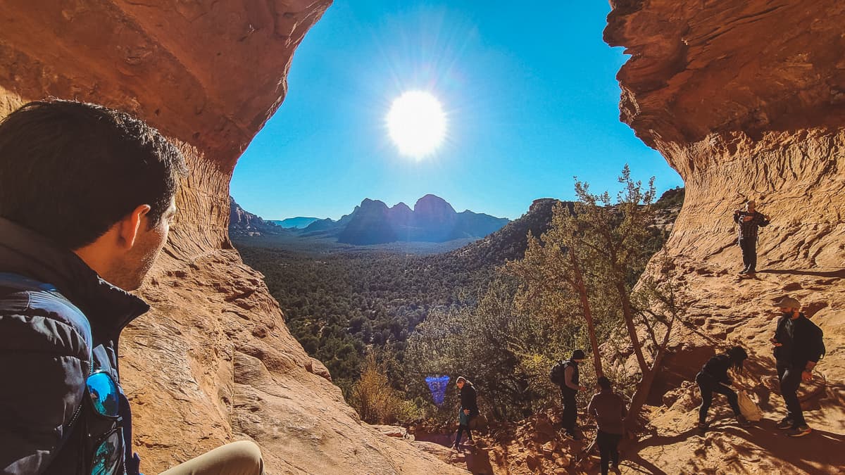
From there, continue about a mile until you reach a fork. Take the right-hand trail and follow it toward a red rock mesa – that’s where you’ll find Soldier’s Arch and the not-so-secret cave.
The climb to the cave is short but steep, with loose rock in spots. You’ll use both hands and feet to scramble up, but the payoff is worth it. Inside, you’ll find a naturally lit chamber that’s cooler than the desert air outside, with a window-like opening overlooking the trail below – a perfect snack spot with a view.
Optional Extensions
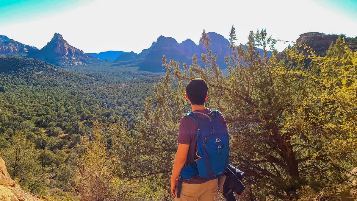
Once you’ve soaked it all in, you can retrace your steps or keep going. Soldier Pass connects to several other trails, including Brins Mesa, Hole in the Sky, and The Mitten viewpoints.
When we hiked it, we extended the route onto Brins Mesa Trail, looping around to Hole in the Sky for jaw-dropping views before returning via Jordan Trail – an incredible way to turn this short hike into a half-day adventure.
Overall, Soldier Pass Trail is one of the most diverse short hikes in Sedona, blending adventure, variety, and unreal scenery in just a few miles. You’ll climb, explore, and photograph your way through some of Sedona’s most iconic landscapes – all without committing to an all-day trek.
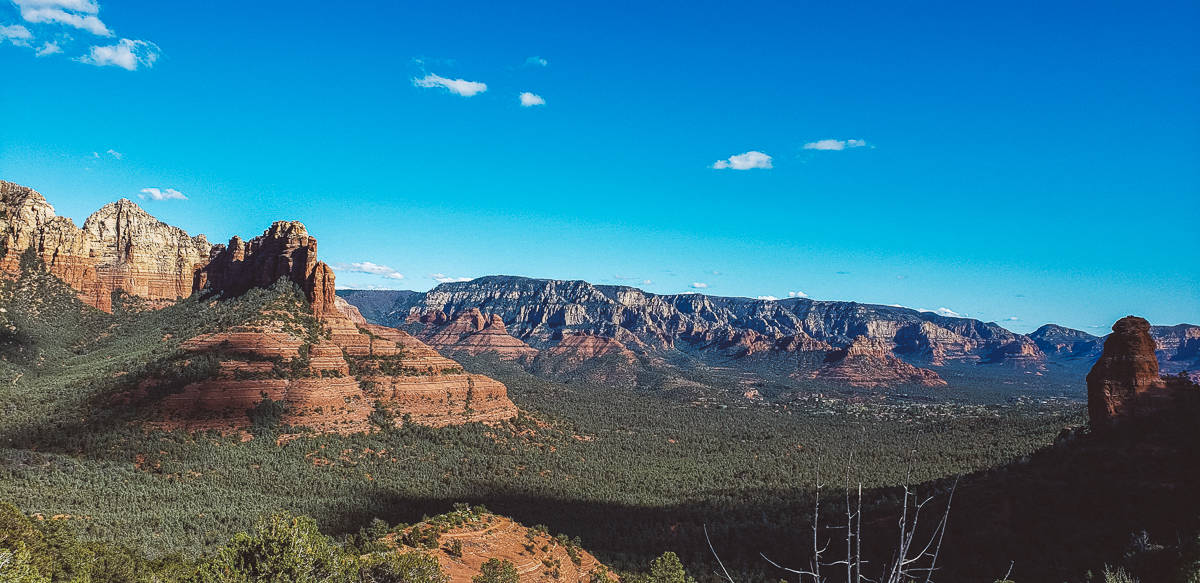
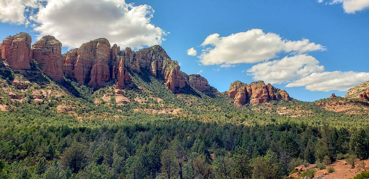
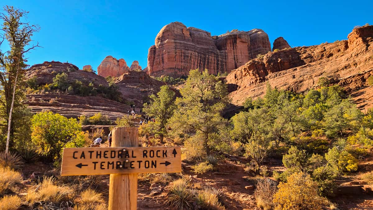
2. Cathedral Rock
- Distance: 1.3 miles, out-and-back
- Elevation Gain: 770 feet
- Why it’s awesome: A short but steep scramble that rewards you with some of the best panoramic views in Sedona.
If you only do one hike during your visit, make it Cathedral Rock Trail. It’s one of the most iconic and rewarding short hikes in Sedona – short in distance, but big in elevation gain, adventure, and jaw-dropping views.
We’ve hiked a lot of Sedona trails, but this one easily ranks as our favorite.
Trail Overview
Cathedral Rock is one of the most popular Sedona hiking trails for a reason: it’s short, steep, and absolutely stunning from start to finish. You’ll climb slickrock, scramble up natural stone steps, and earn bragging rights with every step.
The trailhead is located about 10 minutes south of downtown Sedona, and you can access it from multiple points – the main Cathedral Rock Trailhead, or via the Baldwin and Templeton Trails if you’re linking hikes.
Be warned, though: parking is very limited at both Cathedral Rock lots. The spaces fill up fast, so get there early (before 7:30 AM if possible) or prepare to do the classic Sedona shuffle – stalking hikers returning to their cars and swooping in when they leave.
What to Expect on the Trail
Once you hit the trail, just follow the large basket cairns and the steady stream of other hikers heading upward. It’s hard to get lost – gravity only goes one way here!
You’ll encounter slickrock sections that require using your hands for balance and leverage, especially near the top. This is where good hiking shoes are essential – trust us, flip-flops will not end well here.
As you climb, take plenty of breaks to look back – the views of the Sedona valley only get more dramatic the higher you go.
The hike is short – about 0.7 miles each way – but with nearly 800 feet of elevation gain, it packs a punch. By the time you reach the top, you’ll understand why this is one of the most photographed spots in Arizona.
At the Summit
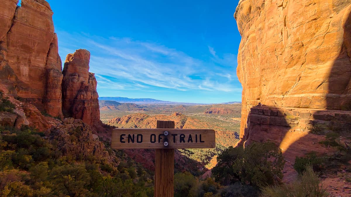
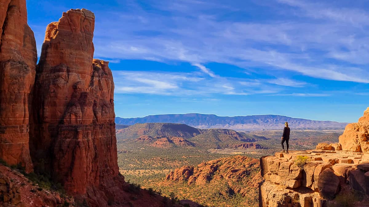
You’ll know you’ve made it when you see the “End of Trail” sign (which feels oddly satisfying after the climb). From here, the views are unreal – vast red rock formations, deep valleys, and that classic Sedona glow.
If you follow the small path to the right, you’ll find the perfect photo spot overlooking the cliffs – it’s the shot you’ve probably seen all over Instagram, and it’s even more impressive in person.
This trail might be short, but it’s one of the most thrilling and rewarding short hikes in Sedona. Between the scramble, the views, and the sense of accomplishment at the top, it’s easy to see why Cathedral Rock is a must-do for every Sedona trip.
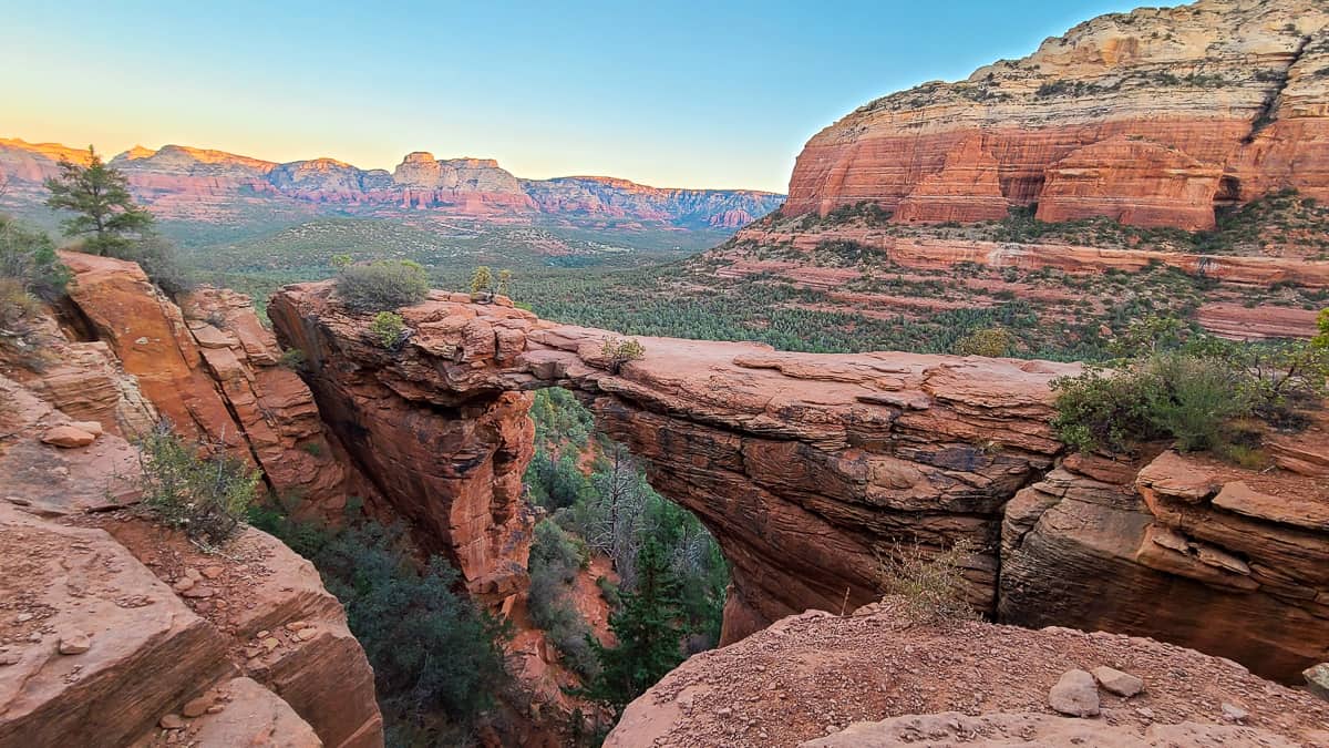
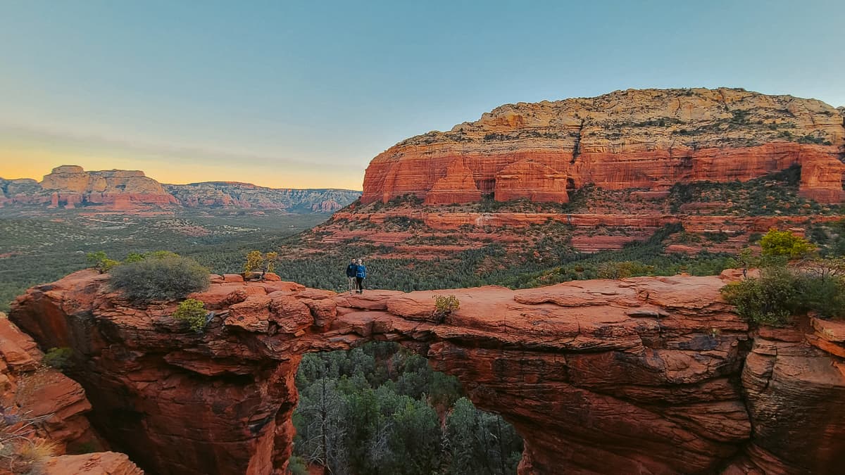
3. Devil’s Bridge Trail
- Distance: 4.2 miles, out-and-back
- Elevation Gain: 560 feet
- Why it’s awesome: Home to Sedona’s largest natural sandstone arch, where you can actually walk across for that unforgettable (and slightly nerve-wracking) photo.
If you’ve seen a Sedona hiking photo on Instagram, chances are it was taken at Devil’s Bridge. This is one of the most popular short hikes in Sedona, and for good reason – it’s accessible, scenic, and ends with one of the most jaw-dropping natural landmarks in Arizona.
Trail Overview
The Devil’s Bridge Trail is a relatively easy 4.2-mile out-and-back that leads to Sedona’s largest sandstone arch. What makes this hike extra special is that you can walk right out onto the bridge itself for that classic Sedona photo-op – just try not to look down too much while you’re up there.
Because it’s one of the most famous Sedona hiking trails, it gets very busy. During the day, there can be lines of up to an hour for a solo photo on the bridge.
To beat the crowds (and the heat), we started hiking in the dark and arrived at sunrise. It was 100% worth it – only a handful of people were there, we snagged our photos in under five minutes, and then watched the morning light paint the red rocks gold. Magic.
Trailhead & Parking Options
There are a few ways to access Devil’s Bridge, depending on your vehicle:
- Without 4×4: Start from the Dry Creek Road parking area and walk the unpaved jeep trail. This adds about two miles round-trip.
- With 4×4: You can drive directly on the jeep trail (carefully – it’s shared with hikers) and park at the small dirt lot near the official Devil’s Bridge Trailhead, saving roughly two miles total.
If you don’t have a high-clearance vehicle, you can also reach the trail via Chuckwagon Trail or the Mescal to Chuckwagon connector.
The Hike Itself
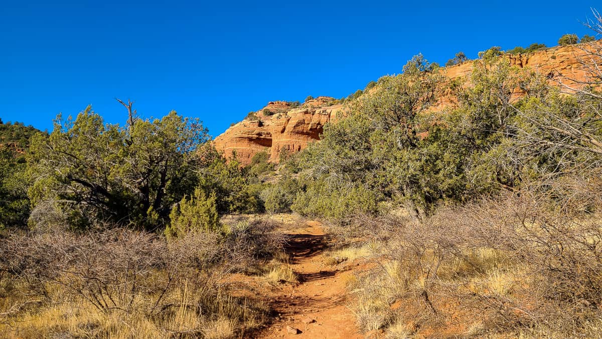
From the official trailhead, it’s just about a mile to the bridge – but that’s where most of the elevation gain happens. The path climbs through red rock steps and slickrock sections before opening to a viewpoint that tricks you into thinking you’re at the top. You’re not quite there yet.
Keep pushing up one last steep stretch and the payoff comes into view – Devil’s Bridge itself, spanning dramatically across the canyon. The drop below is no joke, but the views (and photos) are unbeatable.
Pro Tip: Arrive early to avoid both the crowds and the dust clouds from jeeps driving the first section of the trail.
Devil’s Bridge Trail is easily one of the most rewarding short hikes in Sedona – a little bit of effort for one of the most unforgettable views in the desert. Just bring water, good shoes, and a camera. You’re going to want proof you made it to the top.
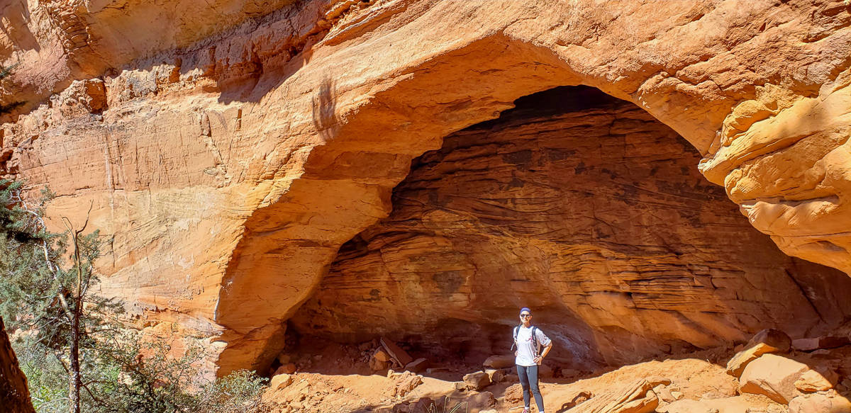
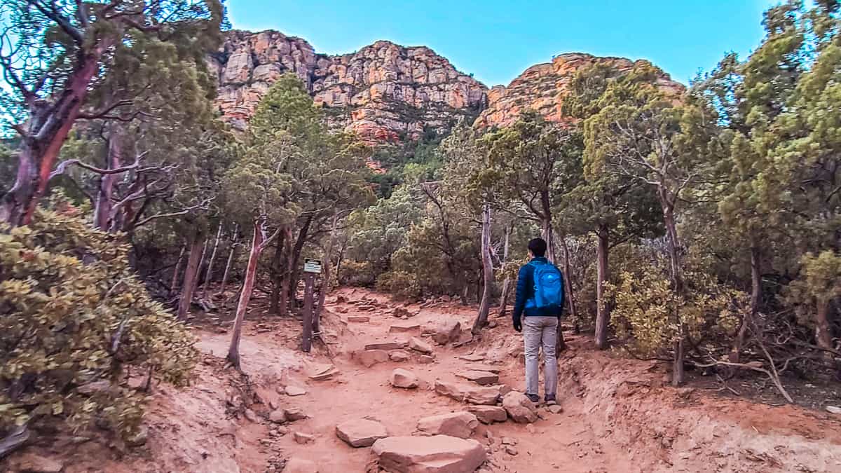
4. Birthing Cave
- Distance: 2 miles, out-and-back
- Elevation Gain: 290 feet
- Why it’s awesome: A short, mostly flat trail that leads to a stunning red rock cave with panoramic views across Sedona.
The Birthing Cave Trail may not be as famous as Devil’s Bridge or Cathedral Rock, but it’s easily one of the most unique short hikes in Sedona. The payoff is incredible – a naturally formed cave with a wide opening that perfectly frames the desert below.
Trailhead & Parking
The hike starts at the Long Canyon Trailhead, which doesn’t have its own official parking lot – just a small dirt pullout on the side of the road that fits about a dozen cars. If it’s full, you can park along the street, but be sure your car is completely off the pavement.
And here’s your friendly warning: don’t trust Google Maps to take you directly to the Birthing Cave. It’ll likely send you through the Seven Canyons Golf Club entrance, where a polite security guard will promptly turn you around and send you back about half a mile to the correct spot.
Trail Overview
The path itself is flat, wide, and easy to follow – perfect if you’re looking for a mellow trail with a big reward. It’s also a popular mountain biking route, so keep an eye (and ear) out for cyclists around blind corners.
You’ll want to download or save your map before starting – there’s little to no cell service once you’re on the trail.
After about half a mile, you’ll pass the golf course on your right. Soon after, you’ll hit a fork in the trail. Take the path on the left, which is partially blocked by a large log – step over it and continue on. That’s the route to the Birthing Cave.
Climbing to the Cave
The final stretch is where the fun begins. You’ll follow a short but steep, rocky incline that leads directly up to the cave entrance. Good hiking shoes with traction are a must here – the slickrock can be slippery.
Once inside, you’ll be greeted with sweeping views of the Red Rock Secret Mountain Wilderness through the cave’s massive opening. If you’re feeling adventurous, there’s a smaller “belly button” nook higher up inside the cave that you can climb into for a truly epic photo (and a little leg burn).
A Bit of History
The Birthing Cave gets its name from its history with the Hopi people, who believed it to be a sacred place. According to local lore, Hopi women would come here before giving birth to pray, meditate, and prepare for labor.
We can’t imagine making that climb nine months pregnant – more power to those women!
Short, peaceful, and filled with history, the Birthing Cave Trail is one of Sedona’s most rewarding short hikes. It’s ideal for a quick adventure that still gives you that “wow” moment Sedona is so famous for.
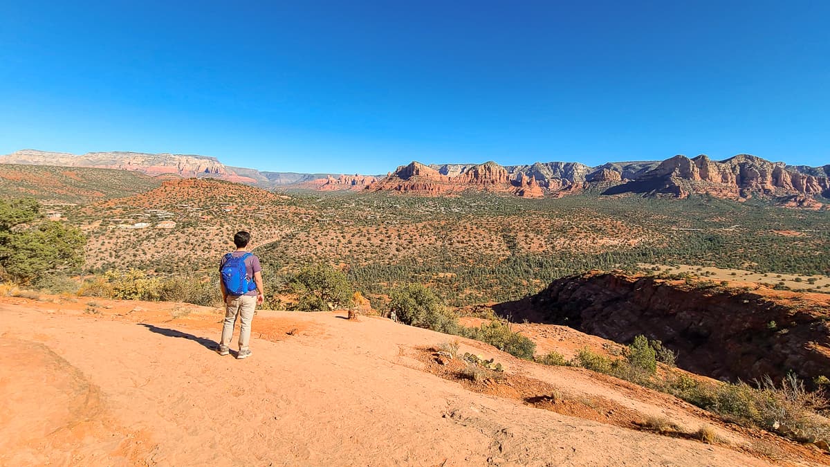
5. Airport Loop Trail
- Distance: 3.2-mile loop
- Elevation Gain: 416 feet
- Why it’s awesome: Easy to access, full of panoramic views, and one of Sedona’s famous vortex sites.
The Airport Loop Trail is one of the easiest Sedona hiking trails to find – it literally circles the Sedona Airport Mesa. Don’t let its convenience fool you though, this loop offers some of the best views in town and a true taste of Sedona’s energy (literally).
This trail is a favorite among locals and visitors alike for its sweeping vistas of Sedona’s major landmarks – Elephant Rock, Courthouse Butte, Bell Rock, and Cathedral Rock – all visible from different points along the loop.
About the Sedona Vortex

One of the things that makes the Airport Mesa area so unique is its reputation as one of Sedona’s most powerful energy vortexes.
If you’re unfamiliar, a vortex is believed to be a natural energy center where the earth’s energy spirals upward, creating a heightened sense of awareness or calm.
Look closely at the trees around the mesa – many appear twisted, which locals say is a sign of that swirling energy. Whether you believe it or not, the combination of peaceful vibes and 360° views makes it worth experiencing for yourself.
Trailhead & Parking Tips
The Airport Loop Trailhead is located off Airport Road, about halfway up the hill. There’s a small, free parking lot on the left side of the road that fills up quickly.
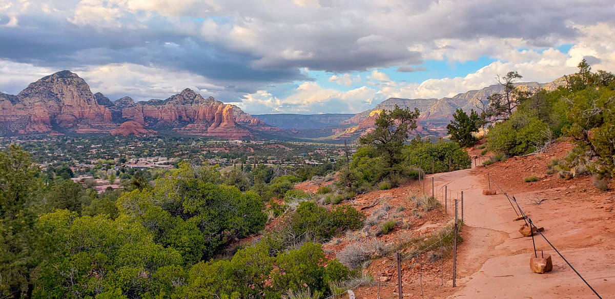
If that lot is full, continue driving to the paid parking area at the top of the hill ($3). From there, you can enjoy a scenic overlook with one of the best panoramic views in Sedona – especially stunning at sunrise or sunset.
This overlook also connects to the Sedona View Trail, which links up with the start of the Airport Loop if you prefer to make a longer route.
What to Expect on the Hike
You can hike the loop in either direction – clockwise or counterclockwise – and both routes offer steady, moderate terrain. The first mile is mostly flat, then the trail gently climbs around the southern side of the mesa.
Along the way, you’ll follow parts of the airport’s perimeter fence and enjoy nearly constant views of Sedona’s red rock formations. The trail is mostly exposed with little shade, so plan your hike for early morning or late afternoon, and bring plenty of water.
The Airport Loop Trail is one of Sedona’s most underrated short hikes – easy to reach, big on views, and packed with that signature Sedona magic. Whether you’re chasing sunrise, sunset, or good vibes from the vortex, it’s an unforgettable way to wrap up your Sedona adventure.
Sedona Hiking Tips & Essential Gear

Before setting out on any of these short hikes in Sedona, a little preparation goes a long way. The Arizona desert is breathtaking, but it can also be brutal if you’re not ready for the sun, heat, and dry conditions.
Practice “Leave No Trace”
Sedona’s red rock landscape is special – help keep it that way. Stay on marked trails, pack out everything you bring in, and resist the urge to feed or touch wildlife.
Sunscreen, Layers, and Hats
Shade can be hard to find on Sedona hiking trails. Always bring sunscreen, a hat, and lightweight layers. We never hike without them – trust us, the Arizona sun means business.
Water, Water, Water
Dehydration sneaks up fast here. We hike with hydration bladders and recommend carrying at least one gallon of water per person per day, depending on your hike’s length and difficulty. In the summer, you’ll need even more – don’t underestimate it.
FAQ: Short Hikes in Sedona, Arizona
How many short hikes are in Sedona?
There are dozens of hiking trails in Sedona, but if you’re short on time, these five hikes under five miles – Soldier Pass, Cathedral Rock, Devil’s Bridge, Birthing Cave, and Airport Loop – give you the best mix of views, accessibility, and adventure.
What is the easiest short hike in Sedona?
Fay Canyon and Birthing Cave are two of the easiest short hikes in Sedona. Both are relatively flat and quick, yet end with impressive red rock views.
What is the most popular short hike in Sedona?
Devil’s Bridge and Cathedral Rock are the most popular, and they get crowded quickly. Start at sunrise or go on a weekday for fewer people and cooler temps.
Do I need a Red Rocks Pass for these Sedona hikes?
Yes, most of these trails are on Coconino National Forest land, which requires a Red Rocks Pass for parking. You can buy one at trailheads or online.
When is the best time of year to hike in Sedona?
Spring (March–May) and fall (September–November) are the best seasons. The temperatures are mild, the crowds are manageable, and the red rocks glow beautifully in the morning and late-day light.
Can I hike in Sedona in the summer?
Yes, but it gets hot – often over 100°F. Start early (before 8 AM) and carry plenty of water. Many trails have little shade.
Which Sedona hike has the best views?
Cathedral Rock offers the best panoramic view in Sedona, but Soldier Pass packs the most variety – caves, arches, sinkholes, and red rock vistas all in one trail.
Best Sedona Hiking & Adventure Tours
If you’d rather explore with a guide (or avoid driving off-road yourself), here are some top-rated Sedona tours to consider through Viator:
- Guided ATV Tour of Western Sedona: Take the wheel and kick up some dust as you explore the red rock canyons and famous filming locations.
- Outlaw Trail Jeep Tour of Sedona: Hop in a rugged 4×4 and ride deep into Sedona’s canyons for unique views of Cathedral Rock and beyond.
- Sedona Helicopter Tour : Dust Devil Tour: For a true bucket-list experience, see the red rocks from above on this 20-minute helicopter flight.
Want more? Click here to see all Sedona tours on Viator.
Final Thoughts on Sedona Hiking Trails
There’s no shortage of short hikes in Sedona, but the trails on this list are our personal favorites for their variety, accessibility, and unforgettable scenery.
Some deliver panoramic views of Sedona’s most iconic formations, others let you scramble across red rock ridges or wander into hidden caves – and all of them promise that signature Sedona magic.
Whichever of these Sedona hiking trails you choose, we can promise you one thing: you’ll either fall in love with the desert or, at the very least, earn yourself a cold post-hike drink.
Thirsty from your hike? Check out:
Let us know your favorite short hikes in Sedona and definitely let us know if we missed any.
Ready to visit to Sedona? Read hotel reviews, check current prices and then book your room here!
Don’t forget to pick up a Sedona guidebook for your adventures.
Love this guide? Have questions? Get in touch with us on Facebook | Twitter | Instagram | Pinterest