Hiking Guide for Cerro Torre from El Chaltén, Argentina
Located in the Los Glaciares National Park, Cerro Torre is the tallest of a 4-mountain chain (Cerro Torre, Torre Egger, Punta Herron, and Cerro Standhart) located in the Patagonia region of Argentina and is considered one of the most difficult climbs in the world – for rock climbing, that is, not hiking.
For hikers, this is a great day hike to Laguna Torre (aka Cerro Torre) from El Chaltén ending with a lakeside view of all 4 needles.
Having completed the Mount Fitz Roy hike the day before, we wanted to hike again, but not scale up another mountain.
The Cerro Torre hike was a perfect option to follow Fitz Roy.
Short on Time? Here are the key takeaways:
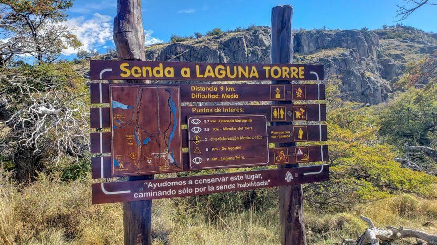
- The Cerro Torres hike is about 18 km (11 miles) round trip with 490 meters (1,600 feet) of elevation gain.
- The first 2 km (1.25 miles) are where the majority of the incline is.
- There are 2 port toilets on the hike. Bring TP.
This post was originally published in April 2019, and was updated in November 2023.
**Boozing Abroad contains affiliate links throughout the site. If you choose to purchase items through these links, we will earn a small commission at NO extra cost to you. Read the full disclosure policy here**
Quick Overview of Patagonia
As we mentioned in our hiking post on Mount Fitz Roy, the Patagonia name was coined by Magellan. His thinking that the area’s inhabitants looked like Patagon, a dog-headed monster from an old Spanish novel.
We can’t make this up. When we found this from the encyclopedia, we had to share it.
Today, Patagonia is made up of the southern region of Argentina and Chile that spans over 260,000 square miles (673,000 square kilometers) and encompasses the Andes mountains, grasslands, deserts and more.
Renting Equipment
We rented trekking poles from an appropriately-named shop in town called Patagonia Hikes; but, there are at least 6 shops where you can rent equipment. See all the detail here on our Fitz Roy post.
To be honest, we didn’t use our hiking poles on this hike, but absolutely needed them for Fitz Roy. If you like to use pole or just want some extra assistance, we suggest taking them with you.
Tour Options and Info
If you are a little hesitant to try this on you own, you can hire a guide. There are also several camping options that combine a few different viewpoints.
Check out these popular El Chalten tour options:
- Full Day Trekking to Laguna Torre: This tour is professionally guided. You will need to pack and bring your own food and supplies.
- 2-Day Hiking Guide (Fitz Roy and Cerro Torre): While we did both Mt Ft Roy and Cerro Torre, this 2-day hike allows you to camp along the trail with supplies, food and a guide included. It’s a great option if you want to camp!
See all the various El Chalten and Patagonia tours on Viator.
Cerro Torre (Laguna Torre) – the Hike
- Length: 18 km (11.18 miles) round trip, 6-8 hours
- Elevation Gain: 490 meters (about 1,600 ft)
- Difficulty: This is listed as moderate or medium, but this hike is relatively flat, and in comparison to the Fitz Roy hike, this is a cakewalk.
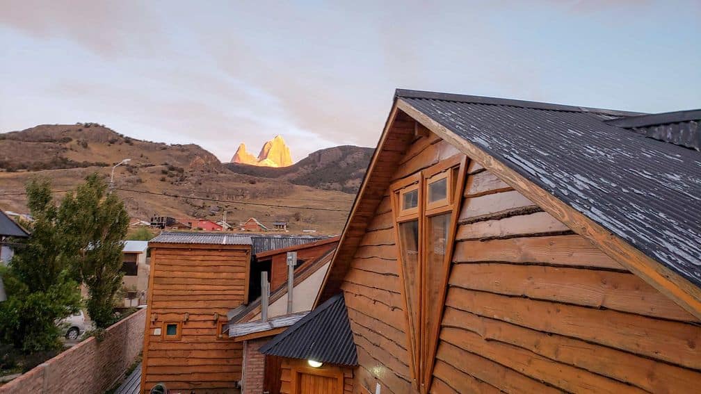
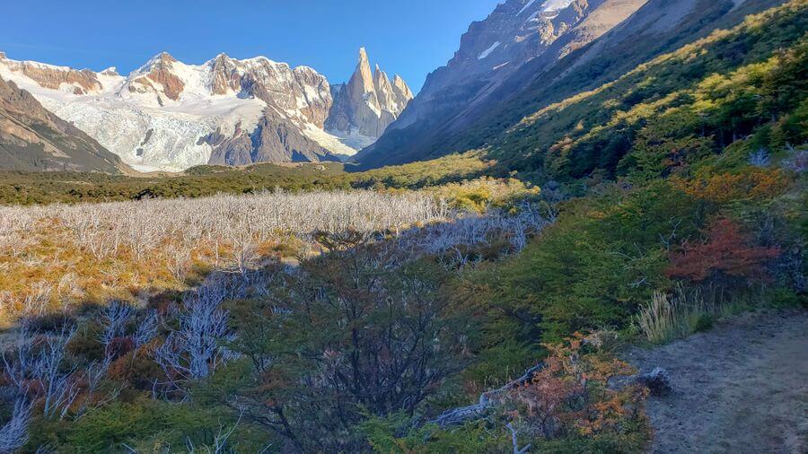
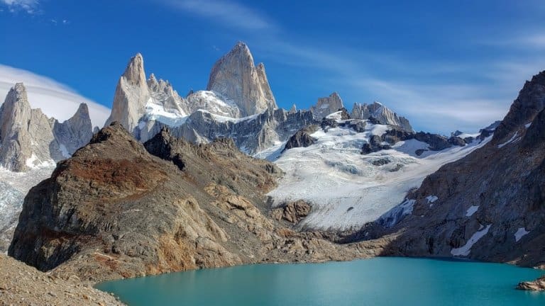
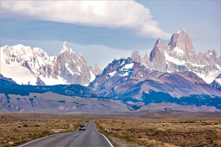
- When to start: We highly suggest starting as early as possible. The first viewpoint of Cerro Torre is about 20 minutes in. If you can get there when the sun rises (or shortly after), you will be rewarded with a gorgeous orange hue on the mountain, similar to what you see on Fitz Roy below.
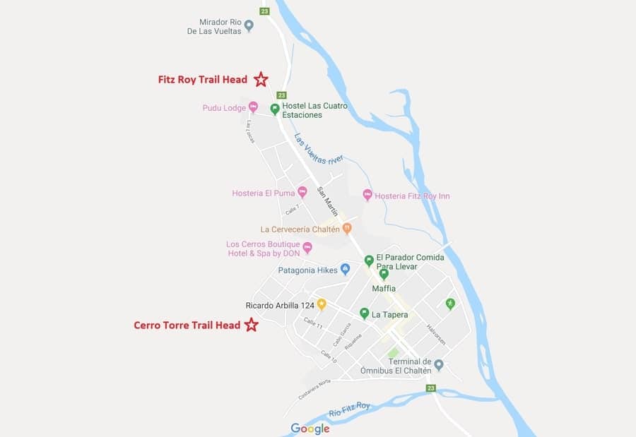
How to Find the Trailhead to get to the Laguna Torre Hike
The Cerro Torre trail head is located at the end of an unnamed road (according to Google) on the northwest side of town.
It’s near the middle of the map below and much closer to downtown El Chaltén than Fitz Roy:
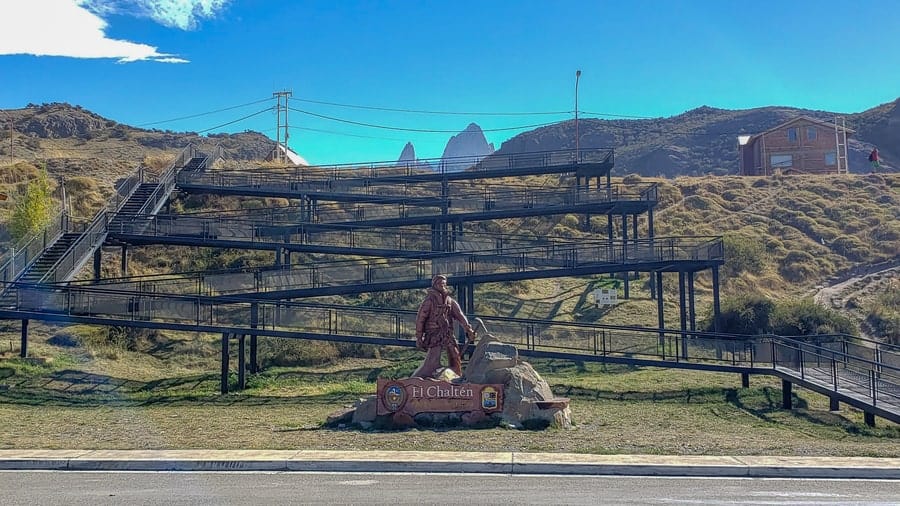
Depending on where you are staying, you will need to climb the black stairs at the end of the main street.
Hang a left and head towards the defined path on the hill.
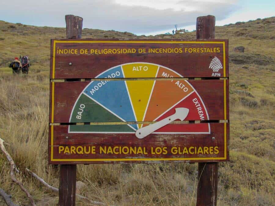
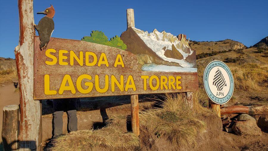
You will see this sign below, and not knowing Spanish, it is about the fire risk, not the level of difficulty for the trail. There is also camping on this trail around kilometer 8.
There are portable toilets near the sites (bring your own toilet paper) and if you do camp, you can NOT use fire to cook food.
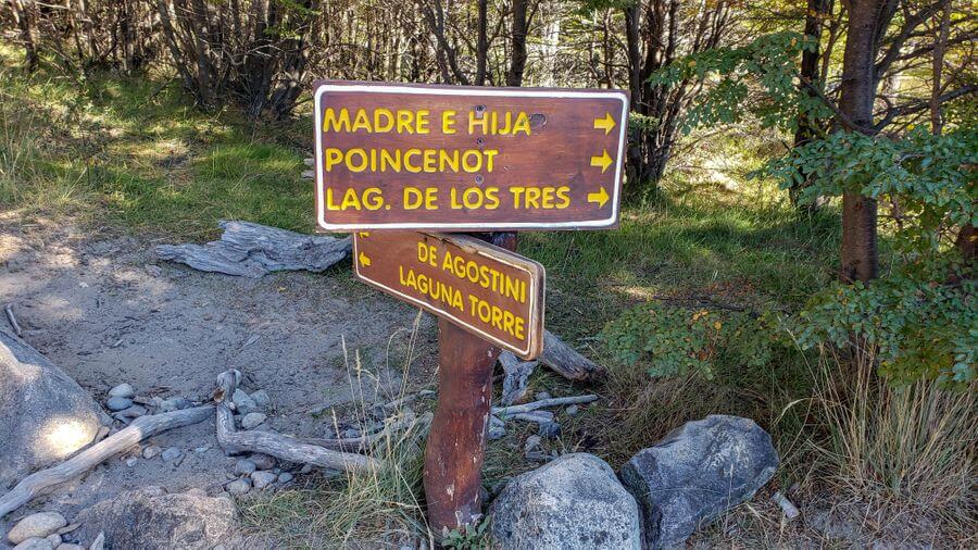
There is a way to combine for Fitz Roy (Laguna de los Tres) and Cerro Torre (Laguna Torre) on a different path which you will be able to access around kilometer 5.
Follow the signs for “Madre E Hija, Poincenot and Lag. De Los Tres”.
All the trails are well marked and you can easily do this self-guided.
Remember, you can drink the water from any stream or lake, so refilling your hydration packs and water bottles is a breeze.
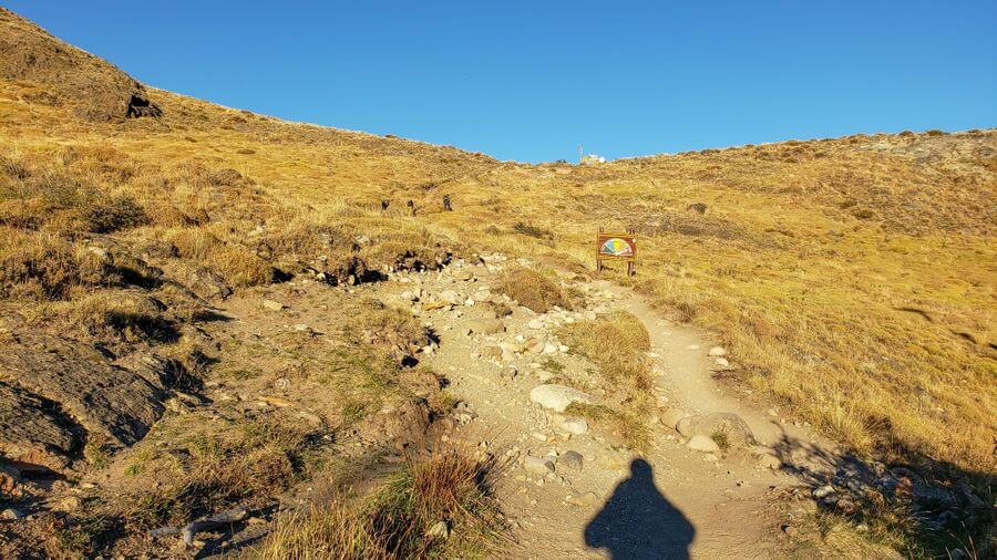
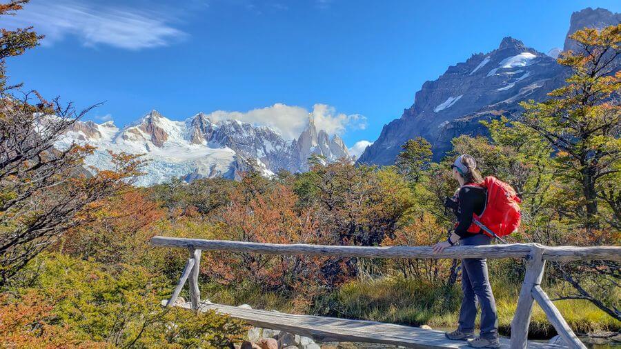
The worst part of this hike starts before you even hit the trailhead. (See above photo)
From the top of this hill to where the trailhead starts is about a 5-10 minute walk up a steep hill, where you will find the trailhead sign.
Make sure you have a hat, sunglasses, and sunscreen as 75% of this hike is not protected from the sun.
As previously mentioned, we did not use the trekking poles on this hike.
Kilometers 0 – 3
60-70% gradual incline
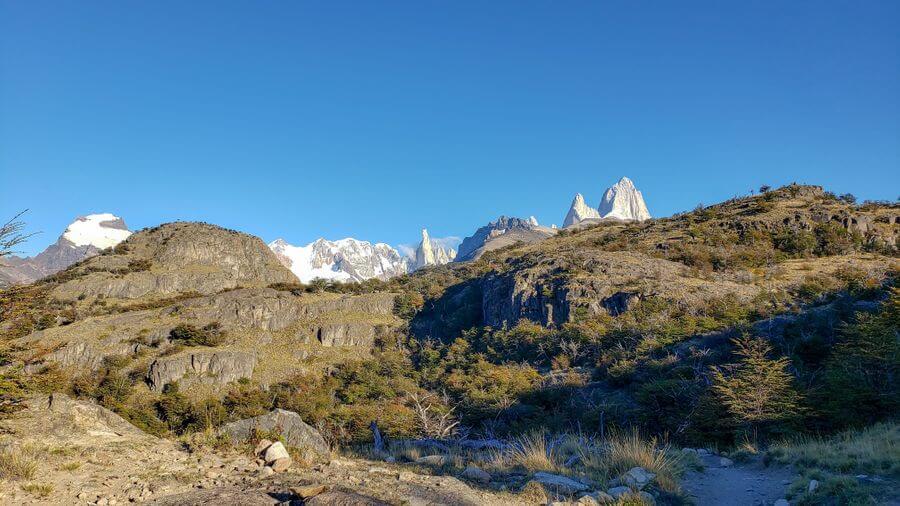
KM 1: While the first couple of kilometers are slightly uphill, you are treated with your first distant views of Cerro Torre and Mount Fitz Roy less than 1 kilometer in (around 20 minutes) at Mirador Margarita.
Mirador Margarita is in no way related to the delicious drink! (Although, a drink would have been nice about now!)
Along this stretch, we were lucky enough to encounter a Magellanic Woodpecker. We stopped for several minutes to marvel at it.
KM 2: Mostly shaded through the woods and roughly 10 minutes past the marker, you reach the Mirador del Torre.
Like on the Fitz Roy trail, there is a sign that details the beautiful view before you.
KM 3: Primarily downhill until you reach the flat open valley.
Kilometers 4 – 6
Flat yet Rocky with views
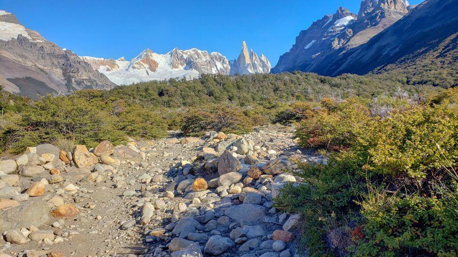
KM 4: Very flat, but riddled with rocks and pebbles and has zero shade.
The views of Cerro Torre are absolutely beautiful, but you can’t enjoy them too much as you must look at where you are walking so you don’t roll your ankle.
If you’re going to look, make sure you plan out a few steps ahead of you so you don’t eat a rock for a mid-morning snack!
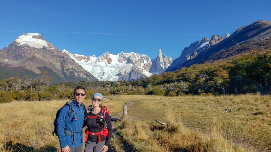
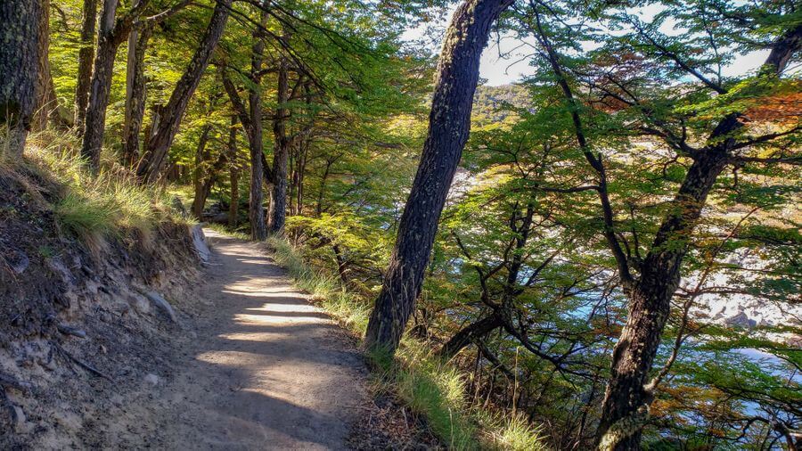
KM 5: Still flat and runs along the side of the mountain.
With less rocks in your path, you are able to really take in the scenery and views of Cerro Torre.
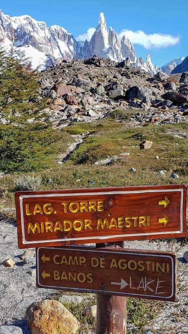
The path will split after KM 5, so make sure you follow the signs for Camp. de Agostini and Laguna Torre.
This is where you can head towards Fitz Roy if you are doing the full circuit.
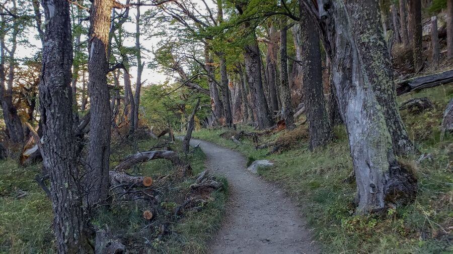
KM 6: In the dense forest. Large trees loom overhead that brings a nice change of scenery and a much needed break from the sun. The path splits here again to go to another campsite.
Follow the Laguna Torres arrows.
Kilometers 7 – 9
Mostly Shaded with Varied Views of Cerro Torre
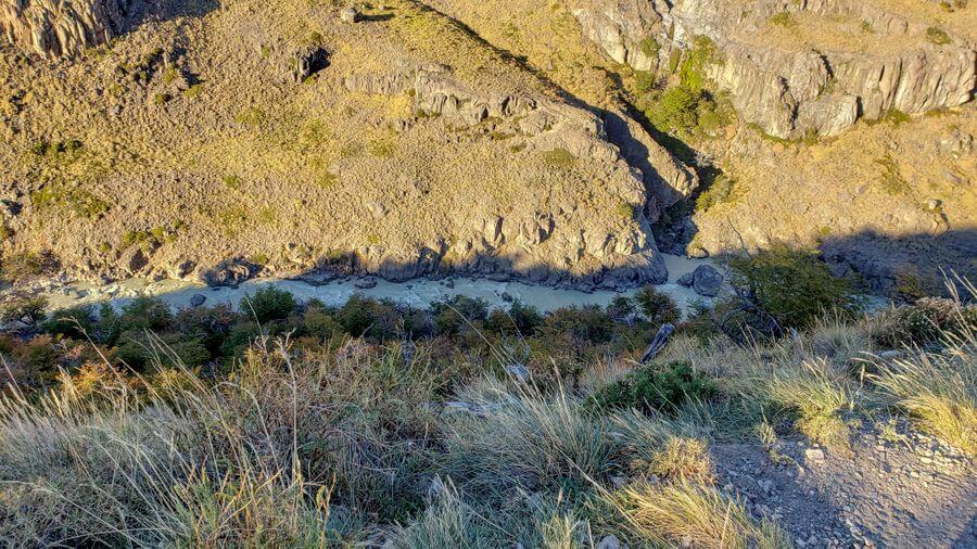
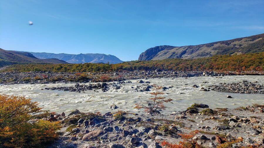
KM 7: The forest-portion of the hike ends and opens to a field of rocks and pebbles again and runs along the river.
KM 8: Back into a forest for a few minutes before turning into a field with rocks. The last little bit of this hike is uphill when you come to another fork in the path.
Going left will take you to a “toilet” and camping. Going right will take you to the lake.
KM 9: The last kilometer is nowhere near as steep or strenuous as Mount Fitz Roy, but there is no shade and the path is thick with pebbles. Once you walk up a hill, you come over the top to see…..
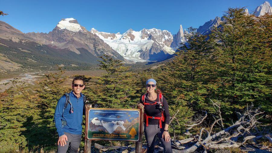
Laguna Torre
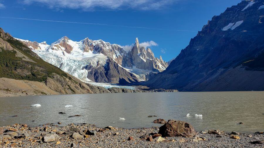
Enjoy this view! This lagoon can sometimes have icebergs floating from the Grande glacier on the mountain.
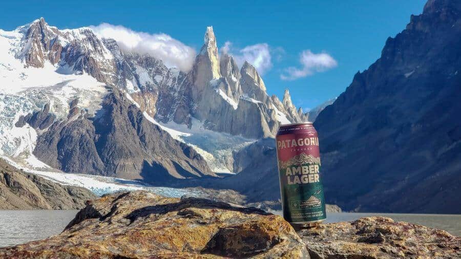

We sat on a log, ate lunch, and once again, enjoyed a nice local beer.
An additional 2 kilometers will take you closer to the glacier to the Maestri viewpoint with an incredible view of the glacier.
We didn’t do this and we regret it. You are already there, please push yourself to do it.
To see a virtual tour of the hike, which is the coolest thing I’ve seen, click here. Click on “Virtual Tour” and press “Start Virtual Tour”. You can see what the entire path looks like!
Things we wish we knew
The first lookout point is only 25 minutes from town.
If you can time it for sunrise, do it. Shame on us for not doing enough research as I’m sure this is somewhere on the web, but we didn’t know and would have altered our time accordingly.
The “toilets” on the trail are 4 walls with a massive hole in the floor.
Thinking about the smell still makes us gag.
Ladies, as mentioned in the What to Pack post, Samantha purchased a Female Urinary Director and she’s beyond grateful she did.
This saved her from having to squat over this hole. It’s awkward, yes, but she couldn’t have imagined peeing without it on this hike.
The Laguna Torre hike to Cerro Torre is a mild and relatively flat hike to see the iconic mountains.
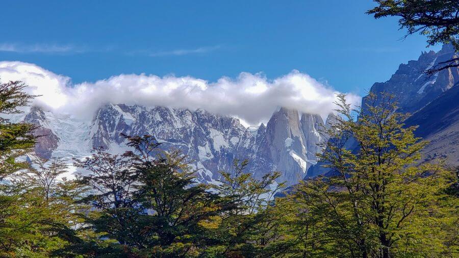
We were very very lucky again on this hike as we were able to see the 3 fingers the entire time without clouds. Below is the picture from the walk back with the cloud blocking the mountains.
Hiking in Patagonia isn’t necessarily a bucket list item for everyone.
The physical requirements alone rule out a large portion of the world’s population as you must push your body to the max. However, this is a great day hike that is worth the truly spectacular views.
We didn’t stop with this hike either. We hiked Fitz Roy and Laguna de los Tres the previous day.
In comparison to Fitz Roy, this hike is a breeze! Some people we talked to did it before Fitz Roy to get ready for that hike, but we chose to do it after.
I’d say that’s the better option since it forced us to keep our body moving and we didn’t get that sore.
Psst! Looking for more Argentina guides? We have a bunch. Browse them all here or check out the most popular post below:

Hi! Great blog – super detailed. Are you saying that “Mirador del Torre” is only 25 mins from the town?
Also, did you do Loma del Pliegue Tumbado? I was wondering if I just did half the hike if I would get to a cool viewpoint? If not, is there something else we can hike/half-hike to see something nice without it being too strenuous? We want to take it somewhat easy our first day as we are doing Laguna de los Tres the next day.
Thanks in advance!
Hi Brian,
Thank you! We appreciate the kinds words 🙂 Mirador del Torre is 9 km one-way from town but the first view point is 2 km. Depending on your skill level, you can get to this view point fairly quickly. However, to get to the end is WAY more than 25 minutes – sorry for any confusion on that. Can you let me know where we typed that so I can correct it please?
We only had 3 days in town so just did the Fitz Roy and Cerro Torre hikes so I’m unsure about the Loma del Pliegue Tumbado. I did a quick search on all trails and I’m not sure that’d be the best one for a warm-up hike: https://www.alltrails.com/trail/argentina/santa-cruz/loma-del-pliegue-tumbado–3?u=i
Safe Travels!
490 KM of elevation gain?!! 😉
haha thanks for letting us know! You mean you don’t want to climb up 304 miles? 😉 cheers